With an abundance of relatively easily accessible peaks situated down Avenida de los Volcanes, Ecuador is a mountaineering heaven. The likes of Tungurahua, Sangay and Reventador are off-limits due to volcanic activity but it still left a variety of different possibilities for all levels, including the ever popular Cotapaxi, Cayambe and Chimborazo mountains. My main goal was the perfect cone of Cotapaxi, and if my hip injury permitted then Chimborazo would be next.
Quito and Riobamba looked to be the best jumping off points for the straightforward popular peaks, with a typical two day ascent and descent, whereas El Altar, Antisana and others require multiday expeditions due to location and difficult technical terrain. The latter will be my goal during our extended Ecuador visit in the near future, and maybe by then Andrea will come along for the ride.
Fortunately due to the altitude of Ecuador’s main cities, and the ease at which I adjust to high altitude, getting acclimatized was no big deal, even with a 16 day Galapagos Islands visit in the middle of our visit. This was not the case for other climbers I happened to be on the mountains with!

Avenue of the Volcanoes
Antisana
Height: 5,753m (18,874ft) Location: Cordillera Real Difficulty: Challenging
Our first weekend in Quito, my Aunt mentioned heading to Antisana for the day. We would need a special permit to get close to the volcano so I emailed the national park and was told we didn’t need anything (I should have brought that email with me!). We had no plans to climb this technical mountain, we just wanted to get up close and personal. It was only a few hours drive from Quito and we headed to the Antisana Ecological Reserve on a beautiful Sunday afternoon with Joyce and Richard. I assumed that the email I sent to park services would suffice on gaining us entry to the volcano but unfortunately only allowed us access into the lower reaches – due to various climbing deaths on Ecuadors volcanoes there are now restrictions in place covering access and guiding. The approach road into the reserve was not quite 4WD terrain but would have made perfect mountain biking – next time we bring the fat bikes!
As usual this time of year views of the mountain are obscured by cloud and we only had occasional glimpses of the snow covered mountainsides, similar to what we would get to see this time of year throughout the entire range. The highlight of the day was the lone and rare Andean condor that flew right over our heads, and then vanished as quick as it appeared. Joyce made a fabulous lunch and we enjoyed a picnic with beautiful views of the volcano.
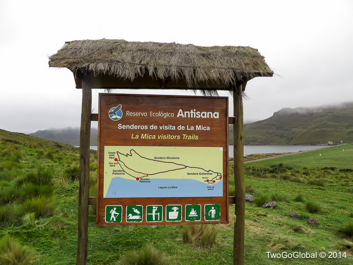
Antisana Ecological Reserve

The best we got of Antisana
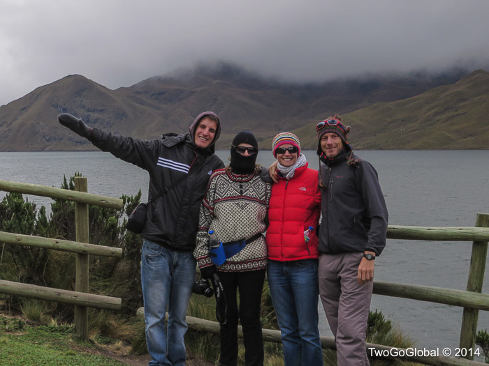
Family day out
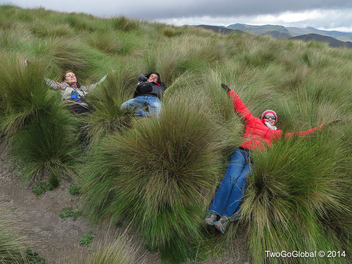
Playing in the pampas grass
Cayambe
Height: 5,790m (18,996ft) Location: Cordillera Central Difficulty: Medium
A visit to the Cayambe-Coca National Park was our second family excursion involving a volcano – having private transportation certainly made our lives far easier, without this trying to get access along the thirty kilometers of dirt from the town of Cayambe would have been impossible. The trail became progressively worse the closer we came to the climbing refuge, although a quick flick into 4WD, Alfonso’s excellent driving skills and the Nissan made relatively easy work of it, unlike the crazy folks attempting it in 2WD vehicles. This is also perfect terrain for mountain biking.
Cayambe, the third highest mountain in Ecuador, is one of the three mountains that companies usually try to get climbers to attempt, with Cotapaxi and Chimborazo being the others. With the Bergé, Ruales, Oleas Refuge (4.650m, 15.257ft) being located at the end of the dirt road it’s simply a matter of hopping out of bed, an easy walk to the nearby glacier, and a five hour glacier walk to the summit. What could be easier? I skipped this one but I’ll let you know next time!

Parque Nacional Cayambe-Coca

The dirt trail to the refugio at 4.650m
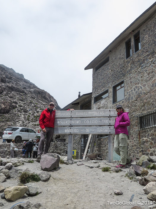
The Bergé, Ruales, Oleas refuge
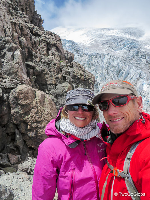
Andrea and I with Cayambe in the background
Chimborazo
Height: 6,310m (20,702ft) Location: Cordillera Occidental Difficulty: Medium
The second and highest of my two Ecuador ascents, only this time I had spent the previous weeks around 2.500 meters so I was well acclimated. Once again I had chosen the two day climbing option and decided to use the services of Julio Verne in Riobamba. After the climbing partner fiasco on Cotapaxi, I ponied up the extra Dollars to have 1:1 guiding – this time not making the summit was all within my control, weather permitting!
I was accompanied by an Italian climber who had also chosen to have a personal guide from the same company – having shared transportation bought our costs down to $270 per person, everything included. Like Cotapaxi, both the refuges on Chimborazo are closed for refurbishing which meant we would be camping just below the Carrel refuge at 4.850m, giving us almost 1.500 meters of ascent that evening. I didn’t think too much about it but after our arrival at camp my Italian climbing partner decided to head up above the Whymper refuge to the glacier, a hike of well over an hour – the kind of mistake that separates the likes of novice climbers and one of the world’s greatest mountaineers! 😉
Chimborazo Reserve

High altitude plants at Chimborazo

Chimborazo campsite
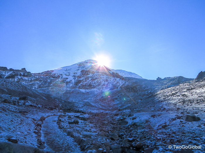
A late 8.15am sunrise behind the mountain
Dinner at 5pm, bed at 6pm, wake-up call at 10pm, departure at 11pm – my body hates this and once again does not allow me to sleep a wink! From 4.800m up to around 5.400m there was next to no snow making for easy hiking on dirt, albeit in huge double plastic boots. Once on the glaciers steeper sections it didn’t take long for my guide, Eloy, and I to forge ahead of the Italian and another couple climbing with a shared guide. I felt great with no effects from the thin air, nor the groin/ hip injury which has been plaguing for me for months now. Once we arrived at 5.800m, the height of Cotapaxi, Eloy mentioned that the others had all turned around – it was so peaceful to personally have the mountain for the rest of the early morning hours.
This was soon spoilt when Eloy mentioned that the steepness and ice on the face was now getting dangerous and we may have to turn back, something I most certainly did not want to hear. I agreed that it was steep as hell but didn’t think we were having any issues going up – it was going down where the problems would arise due to the hard black ice and very little snow. I would worry about this on the descent. For the next 500m vertical meters we waded through ever deepening penitentes, which actually made the face safer but route finding very difficult. My Garmin was now reading well over 6.200m which meant the summit was very close, causing a bit of a problem due to the time being barely after 5am. There would be no sun for at least an hour and this time of the early morning is usually the coldest!
After a few more steps we looked around and realized there were no higher areas than where we stood – it was 5.20am and we were on the top. It was still almost pitch dark, although we could see a very faint orange red line in the distance where the sun was beginning to rise, and an abundance of clouds surrounding the mountain below us. I found Chimborazo easier than Cotapaxi even though its summit is more than 400 meters higher, probably due to having spent more time at altitude in the weeks building up to the climb, and having climbed Cotapaxi within three days of returning from the Galapagos.

On the summit at a far too early 5.20am

One of the steep icy faces
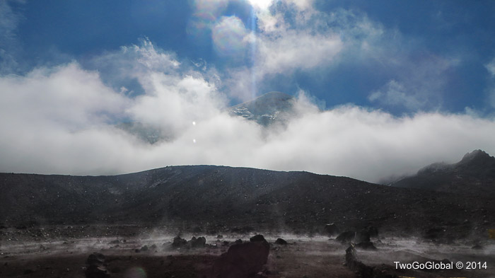
Chimborazos early morning alien looking landscape
Cotapaxi
Height: 5,897m (19,347ft) Location: Eastern Cordillera Difficulty: Medium
I’ve probably spent six months in Ecuador all told and it took until a week or two prior to the climb to actually see the summit for the first time. Apparently in the summer months it shows off almost every day! I had already made a day visit to the national park from Latacunga and climbed to the glacier at just over 5.000 meters – it felt good to know at least the first part of the ascent, even if that was back when I had acclimatization. The Galapagos Islands stood in between the first and second visits, eliminating any altitude adjustments I had made!
For me the risky decision was not only had I been back from sea level a mere three days but that due to the price difference I committed to a shared guide – where were my regular climbing buddies when I needed them? I had no idea what the other client was like. Condor Trekk, a small outfit in Quito had great gear and promised an English speaking guide so I pulled the trigger, paid the $240, and headed to their Mariscal office to meet the others. My climbing partner looked proficient enough, that is until I heard him ask which items were crampons and which was the ice-axe. Was I really going to share a rope with this guy and expect him to be able to save my ass!

Parque Nacional Cotapaxi

A stormy afternoon in the park
It seemed like 2014 was the year of the refuge refurbishment program so we once again had to make do, this time with a cabin full of bunks at around 3.700m. Not quite so good for the acclimatization program given the fact that we had to leave earlier to make the thirty minute drive to the parking lot, followed by an hour hike to get to the José F. Ribas Refuge at 4.800 meters.
With another of those brutal 10pm alarm calls breakfast was served, we kitted up and drove up to the parking lot. I knew that if there was any chance of me making the summit my climbing partner would have to turn back before we made the glacier – this would give our guide a chance to take him back and rejoin me for a personal guided ascent. This wasn’t to be, even though he was complaining about heavy legs within a very short time! This now made the $400 personal guide option sound very attractive. We did indeed end up making it to the glacier, and he did eventually get his crampons fitted, and he most certainly did end up lying on the ice every few minutes asking me how much further we had – I was obviously totally calm and told him with the utmost respect that we still had between five and six hours more to go! I also eventually told our guide that I was not going further with our friend attached to the rope. We were now a long way back from the other teams and at this pace had zero chance of reaching the summit before sunset that night, never mind sunrise. This was when my luck changed as coming down was a guide and his spent European client – a few words later and my rope mate was now on the rope of another team going in the other direction, down.
We soon passed all the other climbers, a couple still heading up but most heading down looking deflated, and with perfect timing got to stand on the summit as the sun rose in the sky. Out of a total 15-20 foreigners trying to stand on the summit this night only four of us made it up – mission accomplished on my first Ecuadorian volcano.

Perfect timing
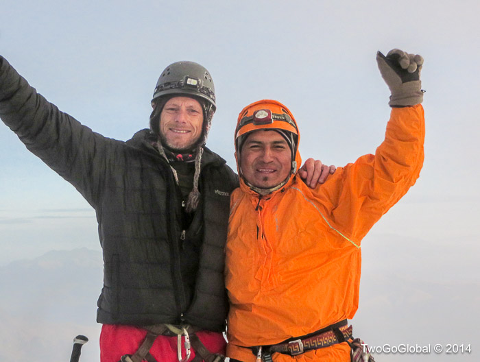
Hugo and I on the summit of Cotapaxi

Illinizas in the distance with cloud far below us

Some of the amazing ice formations

A rare clear Cotapaxi day
Rucu Pichincha
Height: 4,698m (15,413ft) Location: Cordillera Occidental Difficulty: Easy
The slightly smaller and inactive of the two summits of Volcano Pichincha overlooking Quito was to be my acclimatization hike for the next days Cotapaxi climb. Its bigger brother, Guagua Pichincha last erupted in 1999 when it dumped several inches of ash on the city – that was my preferred summit but the ease of access to Rucu made for an easy daytrip. A taxi ride across town and I was at the base of the TelefériQo, rising from 2.950m up to 4.050m in around ten minutes, and all for $8.50 gringo pricing – this felt like cheating but getting up to higher elevations with less oxygen was what I needed.
Once at the top of the cable car it took around an hour and a half to walk to the top of the volcano. I had read reports saying not to do this alone due to robberies but fortunately never felt threatened. By the time I reached the signage declaring the summit the clouds had whipped in and the temperature had dropped, preventing me from trying to reach the active summit of Guagua Pichincha. Oh well, it was probably a stupid idea anyway!
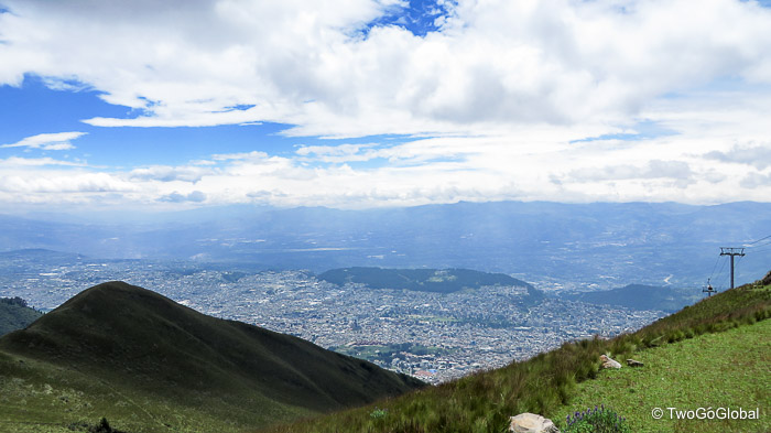
Quito from the top of the TelefériQo

Rucu Pichincha in the distance
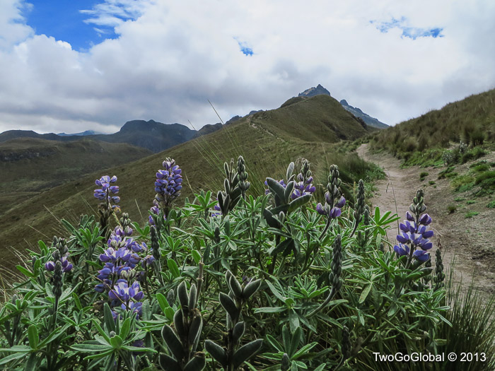
High altitude fauna

One of many graffiti ridden signs

The top!
Tungurahua
Height: 5,023m (16,479ft) Location: Cordillera Oriental Difficulty: Challenging
Impossible to climb when we were in Baños due to continuing eruptions, although disappointingly not whilst we were in town. A week before and a couple weeks after we departed Tungurahua gave some pretty impressive shows to anyone in the vicinity. We lucked out around seven weeks later when we were walking around a Riobamba park and noticed several plumes of ash spewing from the top in the distance – it was still an impressive sight. I had no plans to summit this volatile volcano and Andrea and I were happy to hike up to the Casa de Arbol mirador – unfortunately due to persistent cloud we never really got to see the volcano in all its glory.
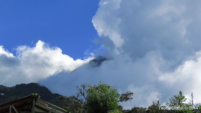
Tungurahua trying to peer through the clouds
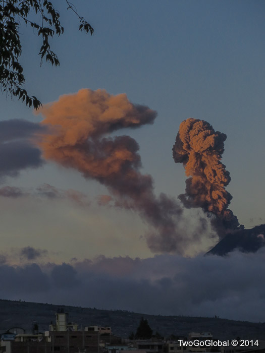
Tungurahua erupting from Riobamba

Tungurahua erupting from Riobamba

