Beginning at mile 0 in Dawson Creek, British Columbia and ending in Delta Junction, Alaska at historical mile 1422, this amazing road trip through British Columbia, Yukon Territories and into the mining heart of Alaska took us six days to complete. We detoured onto the Klondike Loop to visit Dawson City and drive the Top of the World Highway, extending our trip by another hundred miles, lengthened even further as Delta Junction was a hundred miles north and out of the way of our final destination, Anchorage. Also known as the ALCAN Highway for ALaska and CANada, this artery connecting Alaska to the outside world was constructed between February 6th 1942 and October 8th 1942 after the Japanese attack on Pearl Harbor and the threat to the west coast of North America.
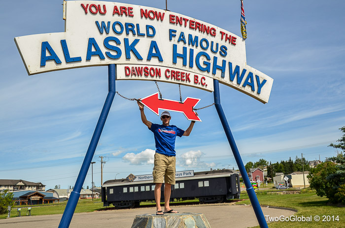
Only 1387 driving miles to go!

Mile 0 at Dawson Creek

The official end of the Alaska Highway in Delta Junction
Andrea was off from work over the July 4th holiday and I hoped that she was prepared to spend a lot of hours behind the wheel, something that we had to do to make our Brooks Fall departure from Anchorage. The worst part was that we had just driven several hundred miles just to get from Prince George, Canada up to the official start of the Alaska Highway. With a good night’s sleep in a soft grass covered campground, an oil change on Going Broke, and as soon as Andrea finished work for the day we were off.

Our driving route from Dawson Creek, up to Delta Junction, and a finish in Anchorage
We used the very handy Alaska/ Canada driving guide, Milepost, and found it to be the most useful, extremely detailed touring map of the entire region – if there was a creek described at mile 109.3, then it appeared at dead on 109.3. What was a little frustrating was that when it mentioned being aware for bears, moose, elk, etc.. at specific locations, they were always wrong as we never did see them! That being said, one evening whilst driving well into the night, we did spot sixteen bears grazing along the side of the road, all within less than fifty miles.
The drive was very scenic, but at the same time pretty mundane, with nothing really standing out for us. Miles upon miles of spruce pines, lakes, and wild flowers were impressive but not quite enough, especially after having recently driven through the scenic byways of Alberta – we needed an erupting volcano, auroras borealis or something equally climatic. Maybe we’ve seen too much over the past two years and have now been spoilt!
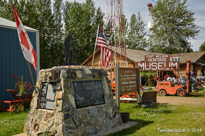
Fort Nelsons cool little museum

Wildflowers and spruce pines

One of the sixteen black bears seen grazing by the road side on a fifty mile stretch of highway
Some of the highlights that did stand out for us were the Laird River hot springs, the Klondike dredge tour in Dawson City and the Top of the World Highway on the road to Chicken. The hot springs were an absolute blessing, especially after arriving early evening, having driven for many hours and getting to submerge in amazingly well kept natural springs.
We loved Dawson City, including its public campground on the shores of the Yukon river, the huge gold dredge no. 8 and its informative tour, and the impressive town buildings, looking like they were straight out of the Klondike gold rush era. Gold was discovered here in Bonanza, Eldorado, Hunker and other creeks back in 1896, and with it came hoards of prospectors from all over North America. In its heyday 30,000 people called this place home, mining some 14.000.000 ounces of gold from the region.

Signpost forest at Watson Lake, Yukon

Steamboat Keno on display in Dawson City

Typical 19th century frontage in Dawson City

Gold Dredge no. 8 in Dawson City

Laird River hot springs
Not far out of Dawson City the road is known as the Top of the World Highway, a scenic drive passing by mining claims winding its way across the border into the US, and a further 43 miles to the small town of Chicken. We had just suffered with our first puncture, discovered fifteen miles from Chicken in the parking lot of a small picnic area – after declining the assistance of the local police I realized I had no idea how to drop the spare wheel, located under the vehicle. Fortunately, after fumbling around for an hour, my smart wife came to the rescue and her suggestion was spot on!
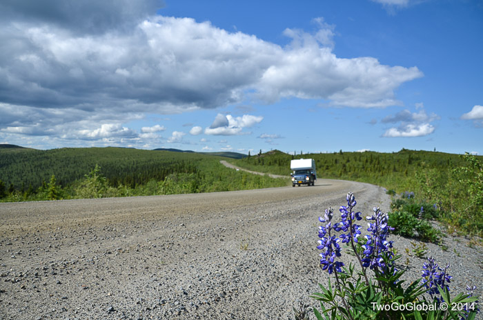
The long and bumpy gravel highway
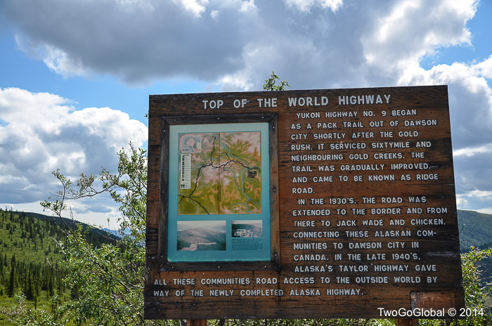
Top of the World Highway signage
From Chicken we should have continued on to Tok, and straight down through Glennallen to Anchorage, although this would have meant missing out on Delta Junction for the finish line photo. For this reason we took the Alaska Highway right to its endpoint, where we arrived at the Delta campground late at night – this was still the July 4th holiday weekend so families and groups of friends were still up gathered around campfires. We were greeted by our campsite neighbors who insisted we come drink beer with them, feast on perfectly made S’mores, and listen to tales of hunting and fishing. What a great way to spend the final night after finishing one of North Americas great road trips.
This night, like every other for the past couple of weeks was lit up well past midnight – I found it great to be able to stay up so late with almost 24 hour daylight. Andrea wasn’t so impressed.

Welcome to Alaska

United States most northerly border crossing
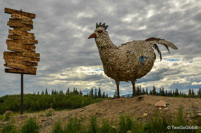
The town of ‘Chicken’
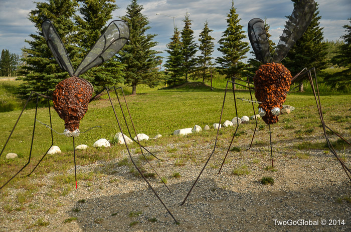
Alaskas state bird, the mosquito
Back when the highway was built it was definitely an engineering marvel, currently still a work in progress as it’s rerouted, bridges replaced, and surfaces re-paved. For us it was a means of getting to Alaska with our vehicle, providing some interesting places along the route and giving us an insight into what was to come when we reached the heart of the last frontier. This northerly part of North America is a vast wilderness with plenty of opportunities to get off the beaten track and discover little touched areas, view some of the worlds most amazing wildlife, and for some, to hunt and fish for that same wildlife.
There are other routes that head north through Canada and up into Alaska, utilizing different roads, giving the driver, cyclist, even walker, different experiences, but we chose the most popular and are overall glad that we did.
June 30th – July 5th 2014

