
Whilst Mont Blanc comes in at the highest mountain in western Europe its normal “Goûter” route is one of the easiest in the Alps. The 4810m snow covered summit looms over Chamonix, the lower glaciers of Bossons and Taconnaz winding their way down from the upper mountain before sadly ending far from where they once were. Not many days went by where I wouldn’t look up from our balcony itching to get back into the thin mountain air – would it be the easy’ish Goûter Route, the AD- graded Three Monts Route, the ‘normal’ Italian Route via the Gonella Hut, or possibly the winter ski-touring route?
The idea to tag it in a single day had also been floating around for some time, maybe not at Killian Jornets lightning fast 5 hours, but still a worthy and realistic challenge. For this to be a possibility there would have to be a prior reconnaissance ascent. That’s where a couple of Danish friends come in – Christian and Soren committed to 4 nights in Chamonix, the decision made to head up the normal Goûter route.
The summit of Mt Blanc and the highest point in Western Europe at 4810m
The weather forecast looked ideal for the midweek ascent, a far cry from the rain and cloudy conditions of the prior few weeks. Not too much of a big deal but we had only managed to get refuge reservations low on the mountain meaning that summit day wouldn’t be that far away from beginning right down at the valley floor.
The plan was to take the Bellevue cable car from Les Houches up to 1800m, the dropoff point being conveniently located next to one of the stops on the Tramway du Mont-Blanc. It was then either a short rack railway ride or a scenic hike up to our accommodation of Refuge du Nid d’Aigle. Perfectly located at 2372m we’d still have a little over 2400m more elevation gain. From there it was all on foot!
A week earlier I had hiked up from the valley floor, passing Bellevue, and Nid d’Aigle, continuing on up to the next refuge; Tête Rousse. Thus far it was all about trail running gear, changing somewhat at the new elevation of 3167m – obviously a bit early in the season to be thinking about tagging the summit in a day in lightweight running shoes! The jaunt up to Tête Rousse provided an insight into our own summit day adventure.
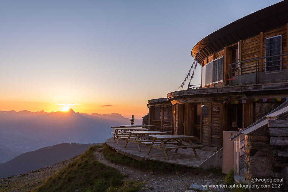
Refuge du Nid d’Aigle
Sunset from Refuge du Nid d’Aigle
Tuesday morning and our departure came around quickly. The weather looked perfect and so did the baguette that I’d thrown together for lunch. As planned the three of us took the cable car to Bellevue, with Christian and I continuing on by foot to refuge du Nid d’Aigle. A quick gear dropoff and we continued on for a bit more acclimatisation, and as anticipated making it as far as the refuge de Tête Rousse. This probably wasn’t the smartest move since we were due to depart not too much later, around 2am on the exact same trail.
We lucked out and along with a Swiss family were the only people staying at the refuge – this meant nobody to disrupt our short nights sleep, hopefully no snorers, and we could walk around our private dorm room in the buff if we so chose! Most climbers make it to this refuge by utilising the Tramway du Mont Blanc, then depart straight away for one of the upper refuges, usually Goûter due to its much closer proximity to the Mt Blanc summit.
Our 1.40am alarm call came far too soon – the lack of sleep nothing that a few cups of coffee wouldn’t fix. Then after confirmation that Christian’s ankle injury might just survive once tucked up into stiff climbing boots, and Soren’s Delhi belly was currently not too severe, we were off into the night.
Refuge de Tête Rousse
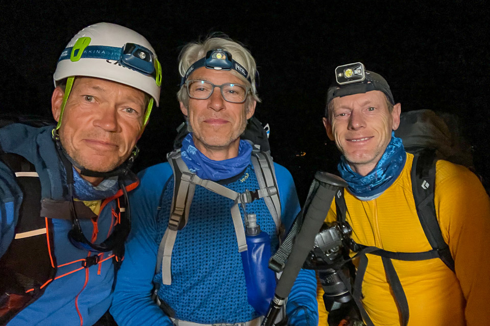
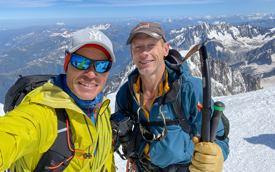
Team “Two Danes and a Brit” feeling motivated
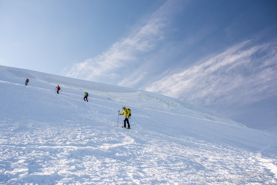
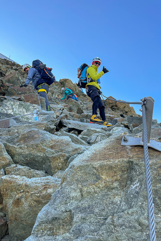
The starry night and balmy temperatures were the perfect start as we made our way along what we thought was the trail, becoming less and less like a human created trail the further we went. It was no use trying to follow the twenty or so headlights up above us; those ibex moved far more gracefully over the rocky terrain than we ever could! With the help of the Gaia app we eventually picked up the trail, our detour still ensuring we gained some good elevation. Around 1hr 40mins after leaving we made our first port of call at a small hut just across from Tête Rousse – it was now time to swap out the trail running shoes, fit crampons, and act like true mountaineers.
With the time hovering around 4.30am by the time we kicked first steps into the early morning snow we were still pretty much alone, the guided parties at Tête Rousse still tucking into their breakfasts. The trail was obvious, the apprehension of the routes primary danger not too far away also fairly obvious! The Grand Couloir kills three people a year on average due to rock fall, the hotspot not a place to dilly-dally.
I had only really paid any attention to it the night before when it was mentioned prior to crawling into bed – a quick Google search and youtube video were enough to warrant a big uptick in the concern level. Huge 100kg boulders careering down the narrow couloir ensuring that anyone in their path was obliterated or slipped whilst trying to avoid the hazard. Luckily a Petzl study showed the worst time to cross is from 5-6pm and that mountain guides are considerably better off than their clients (whilst we’re not guides we’re not clients either!), so we must be safe right? It was actually no big deal; a lot shorter than expected, well trodden snow, and not steep.
It was still crucial to move cautiously as the potential for being struck by rockfall caused by other climbers was considerable. Unlike pretty much every other group we were encountering we were the only ones not roped up nor were we still wearing crampons – for me this meant being able to move at a far quicker pace and hopefully avoid any rockfall. I couldn’t imagine being part of a guided group on this route – been there, done that on other mountains, and so far this has been nothing more than a rocky scramble.
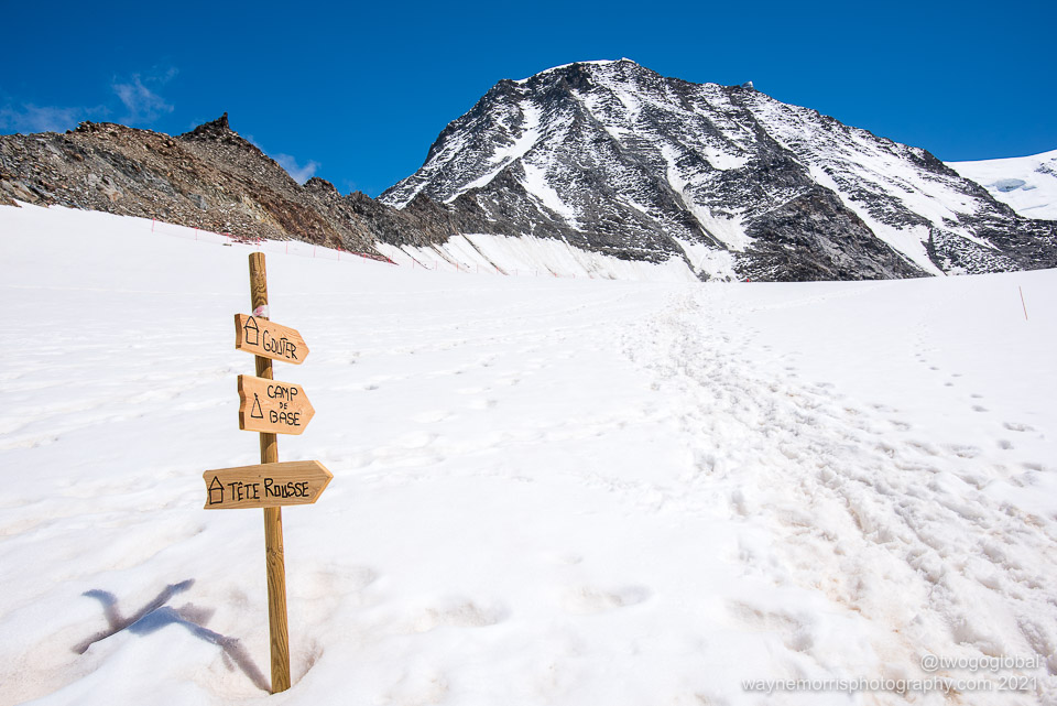
The route to Goûter
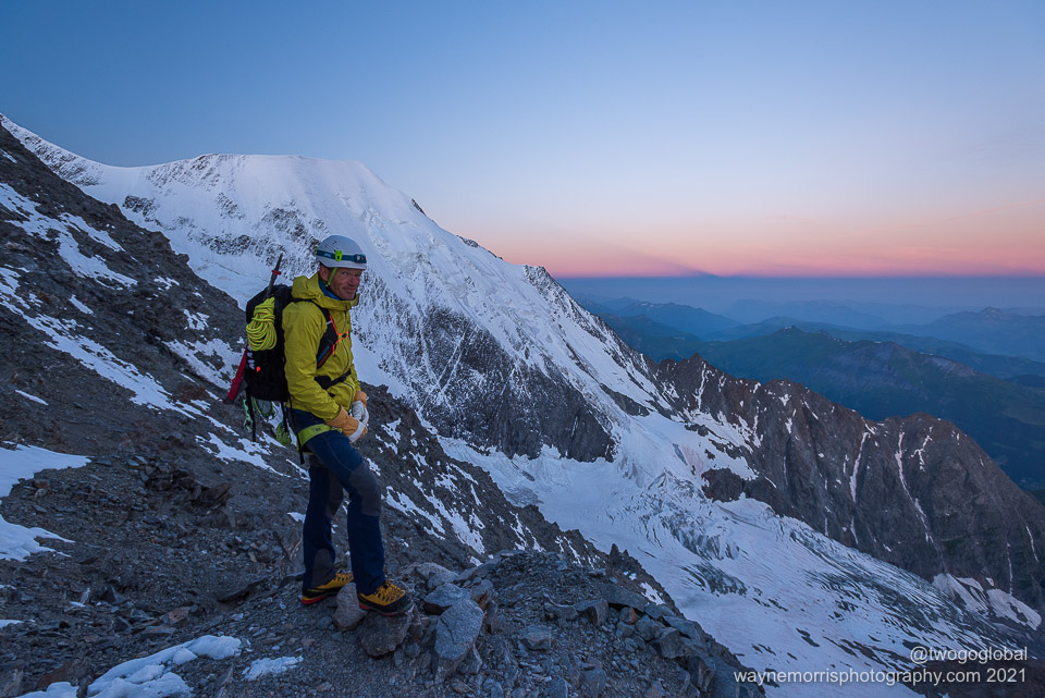
Christian high above Tête Rousse
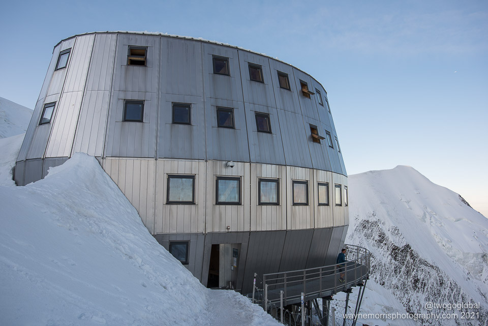
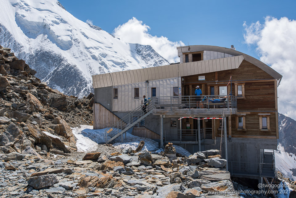
Refuge du Goûter at 3835m
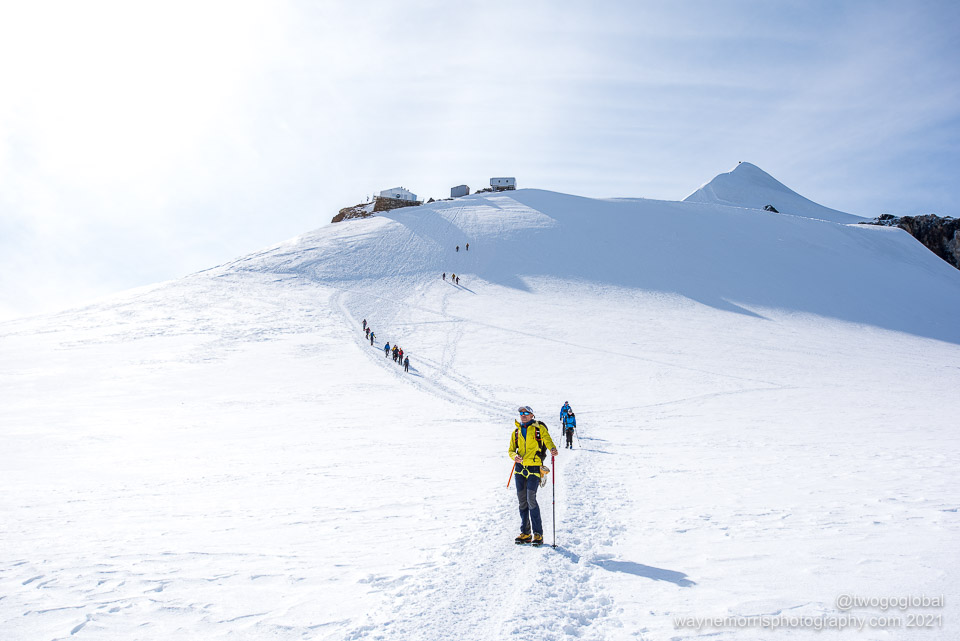
The scramble continued up along a rocky spine that eventually crests at 3835m, home of the old Goûter refuge. The new 2013 hut is a further 200m away. I think we were all glad once we crested onto the snowy ridge, a safe haven away from the dangers of falling rocks. From here on up it would all be on snow, the weather was perfect, and the time only 7am. The final vertical kilometre was going to be fun! An extra bit of good news was that they had three available dorm beds at the refuge; there was no need for us to make our way back down to Nid d’Aigle (other than the fact that my toothbrush was still down there!).
Unfortunately Soren’s stomach issues had gotten worse, amplified probably by dehydration, and for him it was game over. He decided to crash out on one of our newly acquired beds and await our return. By the time we left it was 8am and it seemed that all other teams that had left Tête Rousse were also gearing up for the final push. Christian and I still felt no need to rope up, instead preferring to push on up until the exposed Bosses ridge – for me it was all about the freedom to stop and take pictures whenever I felt like and not be slowing my rope partner down. It felt exhilarating to be on our way to the top of Western Europe!
It was surprising how thin the air had become, each step being somewhat laboured, or was it that we could actually now see the goal and it was mentally still a hell of a long way off. Come on, this was barely higher than Namche Bazaar on the Everest basecamp trek so suck it up and put one foot in front of the other! Off we went…. plod, plod, plod.
Heading up towards Dôme du Goûter
…and then to the Vallot emergency refuge
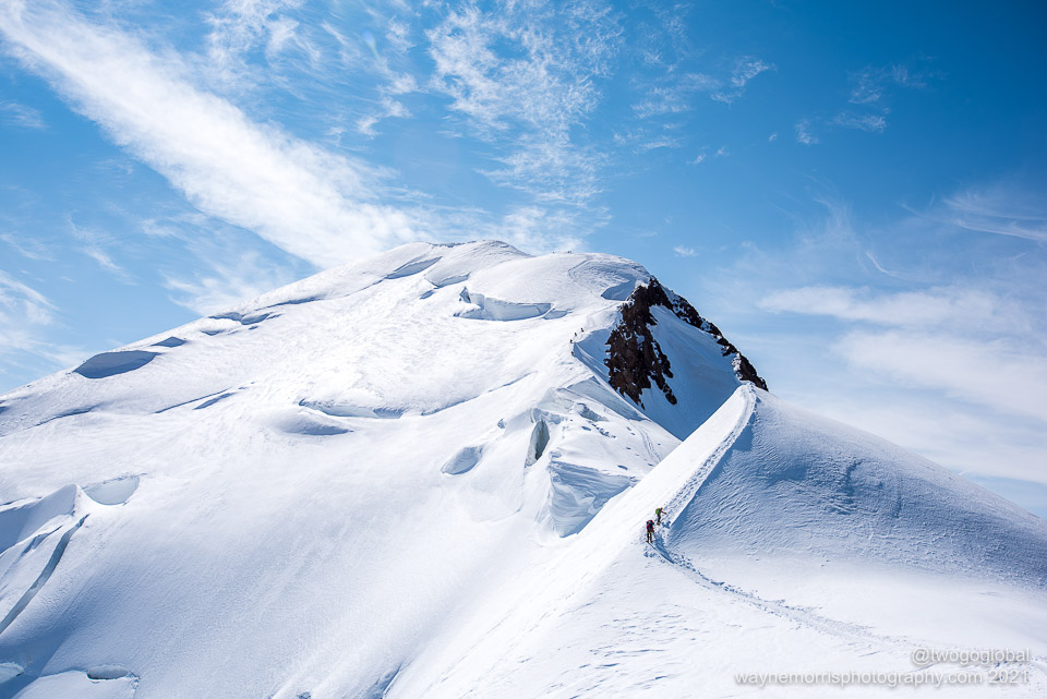
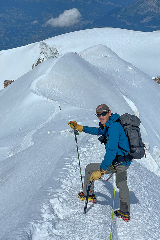
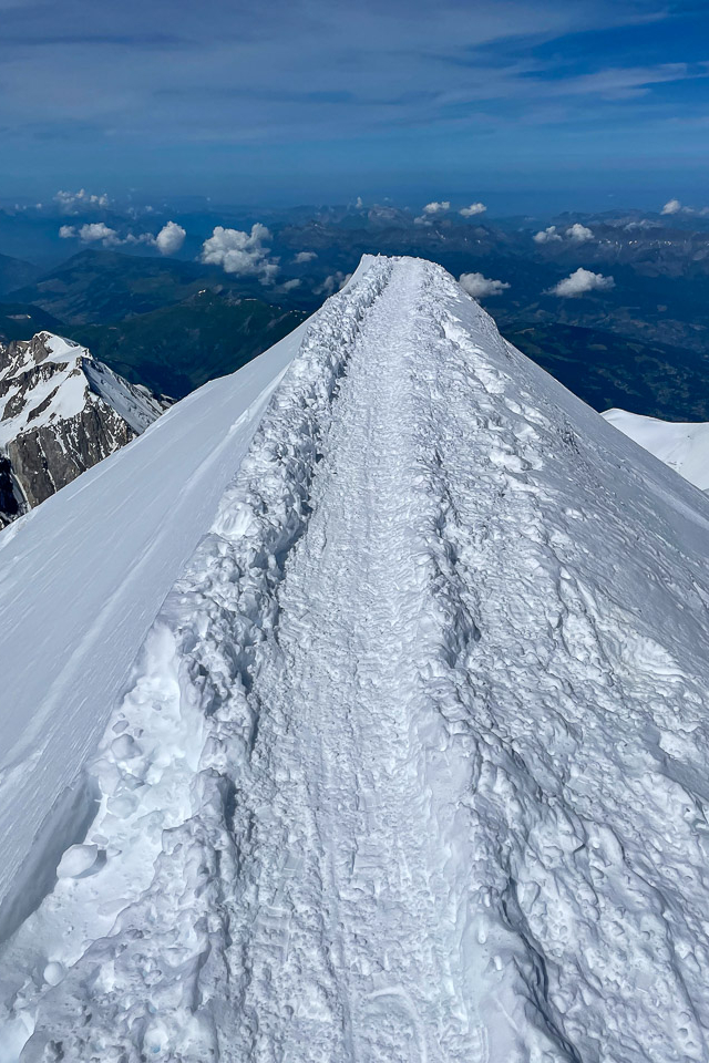
…and finally up the often narrow Bosses ridge leading to the summit of Mt Blanc
First off it was a mild trail leading us up to the Aiguille du Goûter, a mere 30m above the refuge. Continuing along the hugely popular trail the next few hundred metres of elevation gain would have us skirt around the 4304m summit of Dôme du Goûter – there was no need to hit the top; the descent down and back up towards the unmanned Vallot emergency refuge already meaning having to regain lost altitude.
The conditions continued to be excellent; not too warm, the blue sky interspersed with clouds, and amazing visibility – picture perfect for photography. Moving on up the short ascent to the Vallot we encountered our first open crevasse, the decision made to step across and rope up at the refuge. Clearly, from there on up the ridge was often exposed, a concern bigger than the potential of dropping into a crevasse. We agreed that if one of us took a fall into Italy then the other would throw himself into France!
With a touch under 500 vertical metres to go things now became steeper, the climbers nearing the summit still looking like dots. The Bosses ridge is made up of Grande Bosse at 4513m followed by Petite Bosse a little higher at 4547m – whilst most of the ascent from here is still primarily easy terrain there are a few sections where good foot placements and crampon control are helpful, actually vital. Its amazing how even after unclipping from a fixed line at 8500m on Everest to sidestep around people exposure can still mess with you – I can only think that the awareness level is far higher at 4500m!
Bosses ridge descent
The well trodden airy trail
Coming down from Goûter
Our pace was pretty good, the thin glacier rope between Christian and I not causing too much of a slowdown. The reassurance it provided felt good, especially as tiredness crept in! It wasn’t long before we had knocked out both of the Bosses and the final ridge to the summit came into view – we had passed the intersection with the Italian route without even noticing it. A bit more attention and we may have seen the route of our next Mt Blanc attempt.
We arrived at a relatively empty summit a little over 3 hours after leaving the Goûter refuge. The sense of relief felt great as it does with all summits, the perfect weather actually making us feel pretty good (even after the 1:40am alarm call). The excellent summit phone reception meant we could call home before departing ahead of the zoo that was slowly gathering – we didn’t want to be stuck in a conga line with all the inexperience up there!
The descent back to Goûter was uneventful, ditching the rope exactly where we began using it. A bit of an unwanted ascent towards Dôme du Goûter, followed by some direct and knee-jarring downhill took us safely back to the refuge. We were both pretty beat up, and after checking on Soren eagerly ordered a couple of overpriced beers.
Mission accomplished. Ah, maybe not, we still had to retrace our steps back to Tête Rousse and beyond the following morning.
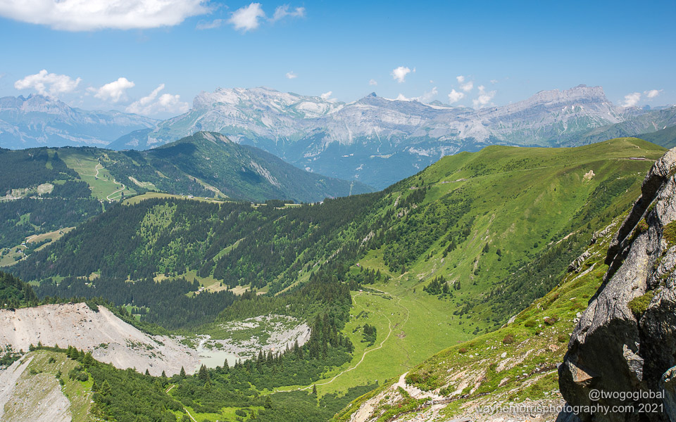
Our return to the land of greenery after the high mountains
As far as I was concerned it was an amazing night sleep; very unusual in a dorm room full of potential snorers and early risers! After a crap €16 breakfast we were off, not bothering with ropes or crampons. The only vital equipment being a helmet, a no-brainer as we picked our way around the roped groups ahead of us, a release of rocks likely at any moment – a sigh of relief was made after safely crossing the grand couloir for the second time in 48 hours. From here on down it was plain sailing.
I had carried trail running shoes all the way to the summit for some reason, not wearing them since Tête Rousse – it was time to make life easier once again and swap out the cumbersome boots! After a couple of lunchtime beers back at Nid d’Aigle Christian and I decided that we should walk back to where the adventure began, leaving Soren to take the train and meet us at Bellevue for the cablecar back to the valley floor.
Now it really was over, just in time for the Danes to pack and to all enjoy a celebratory meal to congratulate ourselves on a job well done.
What would be next? Is the day ascent going to be possible this year now that I know the way!!
Dates
July 20th – July 22nd 2021
Stats
Day 1: Bellevue – Tête Rousse – Nid d’Aiguille
Distance: 13.1km, Ascent: 1,435m, Descent: 800m, Moving Time: 3:39
Total Distance: 13.1km, Total Ascent: 1,374m
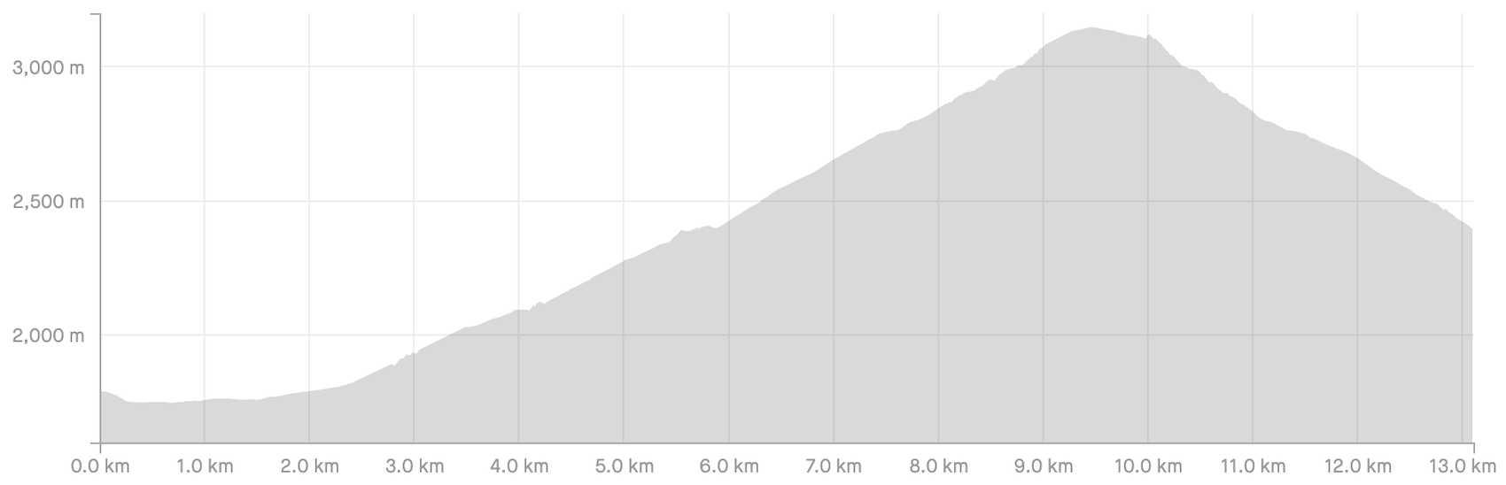
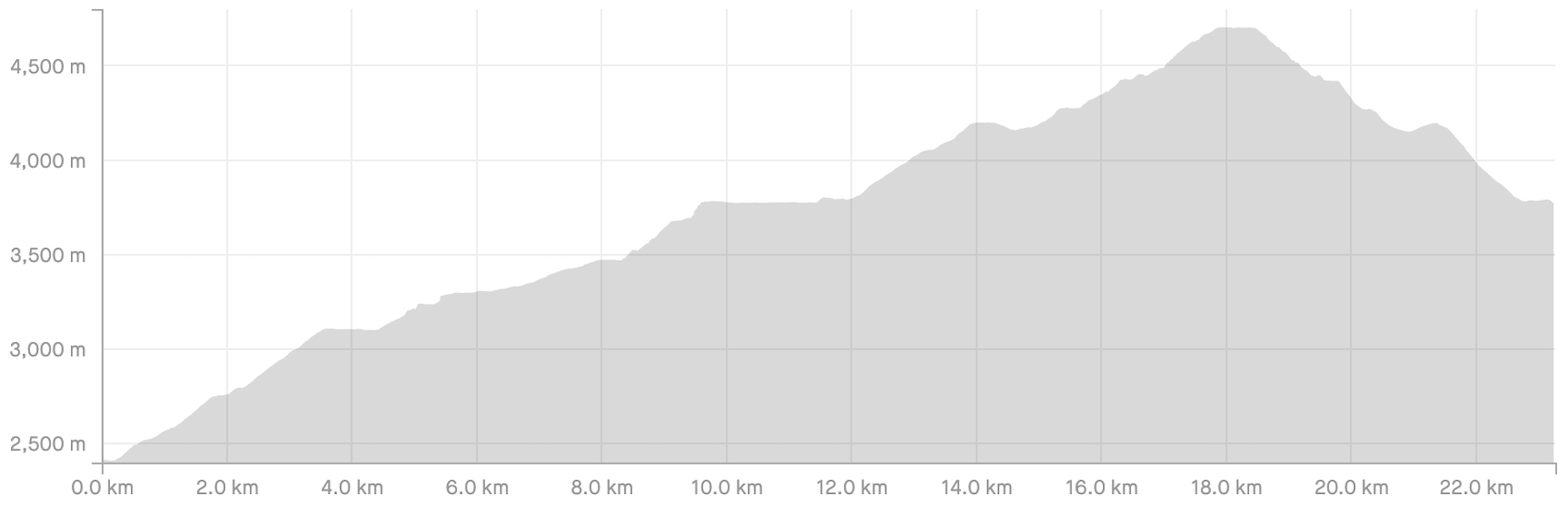
Day 2: Nid d’Aiguille – Mont Blanc Summit – Goûter
Distance: 23.27km, Ascent: 2,506m, Descent: 1,148m, Moving Time: 9:31
Total Distance: 36.37km, Total Ascent: 3,941m
Day 3: Goûter – Bellevue
Distance: 9.74km, Ascent: 61m, Moving Time: 2:40
Total Distance: 46.11km, Total Ascent: 4,002m

Accommodation
Refuge du Nid d’Aigle – €67.20 HB
Refuge du Goûter – €118.20 HB
Highlights
Grand couloir, Refuge du Goûter, Bosses ridge
