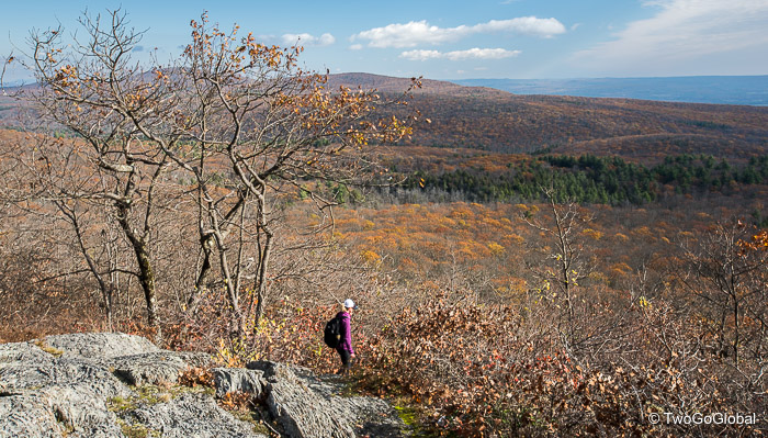
Our love, (wait, did I say love!) for driving is once again taking us on a repeat route up towards Massachusetts, this time to bag more of those ridiculous state highpoints. Last time we were out this way we skipped six on the east coast as we were over driving, leading us to be in the situation we’re in now. We do have a couple of weeks to waste before having to be in Florida and we do have friends scattered along our chosen route, both good enough reasons to be back on the road!
Once again we left Andrea’s family back in Kentucky heading east into West Virginia to knock off Spruce Knob, then on to New Jersey for the aptly named High Point, Connecticut’s Mt Frissell and Massachusetts Mt Greylock a day later, before finally hitting the almighty 812′ Jerimoth Hill in Rhode Island and 448′ Ebright Azimuth in Delaware.
The odd one out in this blog is Utah’s Kings Peak, a summit we tagged back at the end of August but hadn’t written about.
Utah – Kings Peak
Altitude: 13,528′ ● Summited: 8/26/17 ● Route: Up/ Down: Henry’s Fork Trailhead
Being the last weekend before our 17 days on the John Muir Trail we felt we should do at least one hike with gear and packs that somewhat simulated what was to come, unfortunately probably doing us no good whatsoever due to the late hour. We would have a measly 3 days between Kings Peak and the JMT if things didn’t go as planned. Mentally it did make us feel like we were somewhat prepared!
We were en route from Bozeman to Lone Pine so the detour to Ogden and on to the trail head at Henry’s Fork didn’t initially seem too bad. A little research would have showed we had to drive 150 miles on the Friday afternoon, taking around 3 hours! Conveniently we had an airbnb booked in Ogden, Utah for the Thursday and Sunday nights – the hosts nicely blocking out the dates in between so we could leave all of our non-hiking gear over the weekend.
The drive took us mostly along Interstate, from Utah into Wyoming before dipping down again into Utah and the impressive Uinta-Wasatch-Cache National Forest. This entire area is a recreational playground covering over 2 million acres with wilderness, scenic drives, boating, hiking, winter sports and mountain biking. Luckily we had directions to the Henrys Fork trailhead in our phone well in advance as the final few miles were a maze of forest roads with few directional signs. Encountering barely a couple of other vehicles on the drive we were amazed when we arrived to a large packed out parking area – we snagged the last available place that didn’t require any additional hiking.
Our goal was to cover around 8 miles to the Dollar Lake camping areas by dark on the Friday afternoon – this would leave us a pretty intense 13 mile roundtrip to the summit followed by 8 miles back out to the parking lot on Sunday. All we asked for was accommodating weather!
Throwing on our not-so-heavy packs at the 9,400′ trailhead made us instantly fear what was to come at the JMT trailhead a few days later! We had no loaded bear boxes, fewer clothes and substantially less other stuff, instead opting to bring along only what was necessary for 3 days of peak bagging. On top of that we only had to carry packs to the camping area where we were spending both nights!
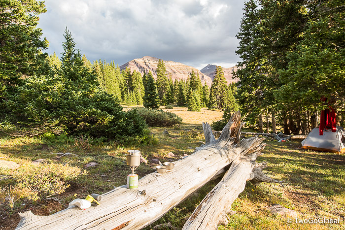
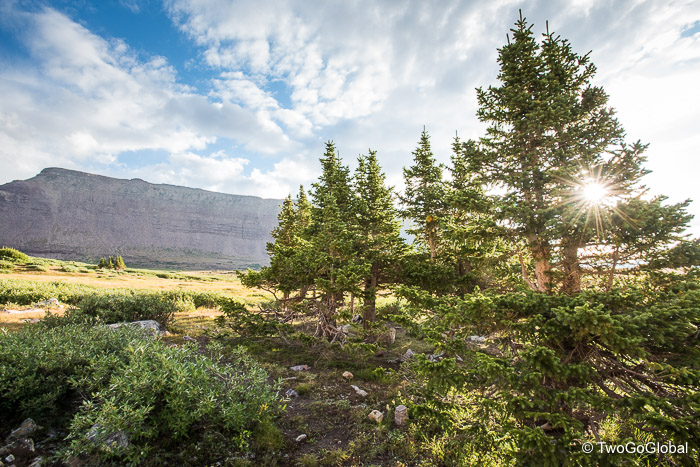
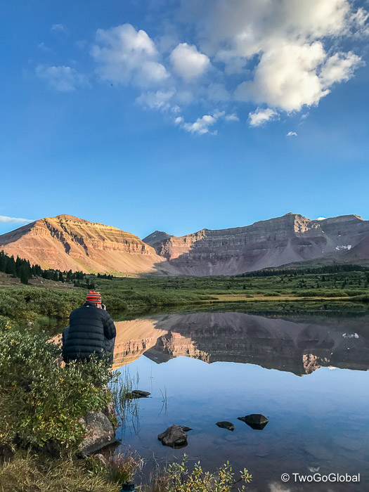
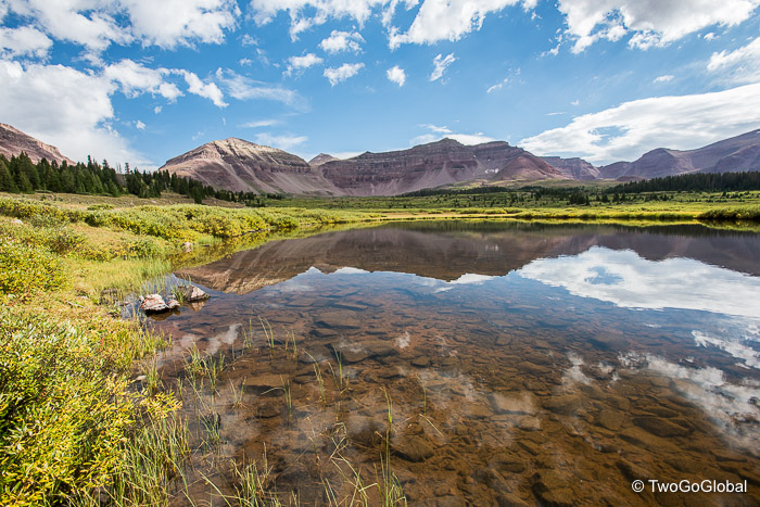
The hike itself was almost all forested, following Henrys Fork Creek up to Elkhorn Crossing where we diverted away slightly. At the crossing a couple of USFS workers reiterated the warning on fires and camping too close to water supplies. We were now in more open terrain and with the high risk of afternoon thunderstorms decided to do what almost every other hiker had done and find a sheltered campsite in amongst small treed covered areas. We ended up beyond Dollar Lake with a great site a hundred yards from another small lake, clean enough looking to supply our water for the next 48 hours. At dawn and dusk the surrounding mountains cast a perfect reflection into the typically still waters.
Covering 1,400′ of elevation gain to our camping area still left us with 3,500′ over 6.5 miles to the summit of Kings Peak. Knowing that the Uintas are high risk for afternoon storms and having no place to shelter once we left camp we had to be back by early afternoon – an early morning beckoned.
Two miles and a few switchbacks after leaving camp we arrived at Gunsight Pass, still a lowly 11,900′ but our first significant port of call. From here we knew that a shorter route existed that would have all but eliminated the unwelcome descent into the Upper Painter Basin below, unfortunately being unable to locate it we had to go up and over. The well used trail was easy to follow and with awesome surrounding views we didn’t feel like it was too big of a deal to lose much of the vertical footage we had gained! So far the weather had been good to us but heavy looking early morning clouds were looming in the distance.
The following section took a route across extremely open and exposed terrain, which given blue skies would have been perfect but not so much fun in sketchy conditions. I had read too much online indicating how important it was to turn back if the weather took a turn! The next stop en route was Anderson Pass at 12,800′, the turnoff point for the final boulder hopping jaunt to the top of Utah.
Upon our arrival at Anderson Pass we were greeted with a nice big turd, almost definitely of the human variety – some kind soul had deposited it smack bang in the middle of the trail and admired their handiwork enough to feel no need to cover it up!
Luckily for us good weather had by now pushed out the bad leaving behind almost perfect conditions for the final mile and a half push up the north ridge. With no real trail up the boulder slope it was a case of finding the best, most secure way through – staying closer to our right followed along a big dropoff but this seemed to offer the best route to the top.
Three and a half hours after leaving our campsite we could go no further, standing atop a peak with one of the most dramatic prominences of all mountains in the lower 48. Now all we had to do was retrace our steps back to our lakeside retreat and crash out for the rest of the afternoon. Over the 7 hours spent hiking we were fortunate enough to only get caught out once in rain, the final ascent up Gunsight Pass being a wet one.
Not the perfect trial run for what was to come but the 3 dqys we spent in the Uintas was an experience worth repeating. Amazing scenery from start to finish, no crowds, and 29 challenging miles. Bagging state highpoints is highly recommended and takes us to parts of the country that we may otherwise never have made it to.
Bring on 220 miles of the John Muir Trail…
West Virginia – Spruce Knob
Altitude: 4,863′ ● Summited: 10/27/17 ● Route: Up/ Down: Drive then 5 mile Huckleberry trail hike
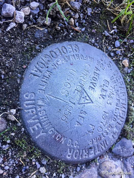
Setting off from Kentucky we had a 340 mile drive ahead of us to the small community of Seneca Rocks where we had found a cute wooden cabin to spend the night. From there it was a further 45 minutes of winding road to the highpoint parking lot. Yes, this was another one of the summits that you can drive up to! To compensate for the drive-up we made sure to hit the trails in Monongahela National Forest.
A better alternative to driving would have been to get our bikes out and cycle the final hilly 10 miles along Forest Roads 112 and 104. The time of day dictated otherwise. Although the roads were remote there was an abundance of vehicles in the parking lot, people out hiking and camping on the multitude of forested trails.
We started on the short Whispering Spruce trail, quickly hitting the state highpoint where the lookout tower provided views of the surrounding national forests. From there we headed out along the Huckleberry trail for a 5 mile out and back, eventually arriving back at the SUV in time for dusk. As others have said this area is a great place to hike with scenic overlooks and many camping sites scattered throughout the trails.
New Jersey – High Point
Altitude: 1,803′ ● Summited: 10/28/17 ● Route: Up/ Down: Appalachian Trail
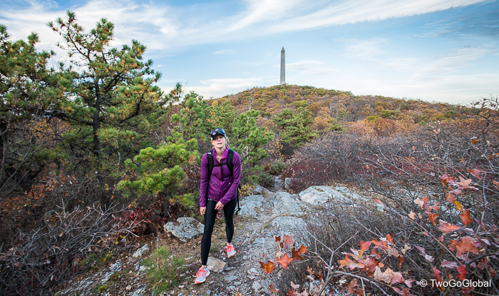
Another irritating drive-up but with plenty of hiking options along the Appalachian Trail and surrounding the monument this wasn’t a big deal. High Point is definitely not an obscure state summit in the middle of nowhere, with the summit monument coming into view many miles before actually reaching it. We had driven over 6 boring hours from Seneca Rocks, West Virginia, covering almost 400 miles to make it here for a mid afternoon hike – a partly cloudy Saturday ensured we had plenty of company.
A quick search on Google and I had come across an 8 mile hike that would throw in some Appalachian Trail and a couple of local state park trails – almost looked like a loop within a loop on a lollipop! The AT parking lot was rammed, our SUV squeezing into the last available spot with the bike rack reversed securely into the trees to protect our bikes.
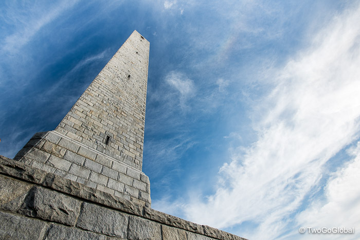
The rocky Appalachian Trail took us a mile and a half to the 220′ tall obelisk war memorial marking the New Jersey highpoint, before veering off onto the less heavily used Monument trail and finally the quiet Cedar Swamp trail. With packed parking lots it was amazing to see so few people once we left the AT. Our entire 3 hour hike didn’t provide much elevation gain but was an ideal way to spend the afternoon following the long drive to get there.
Massachusetts – Mount Greylock
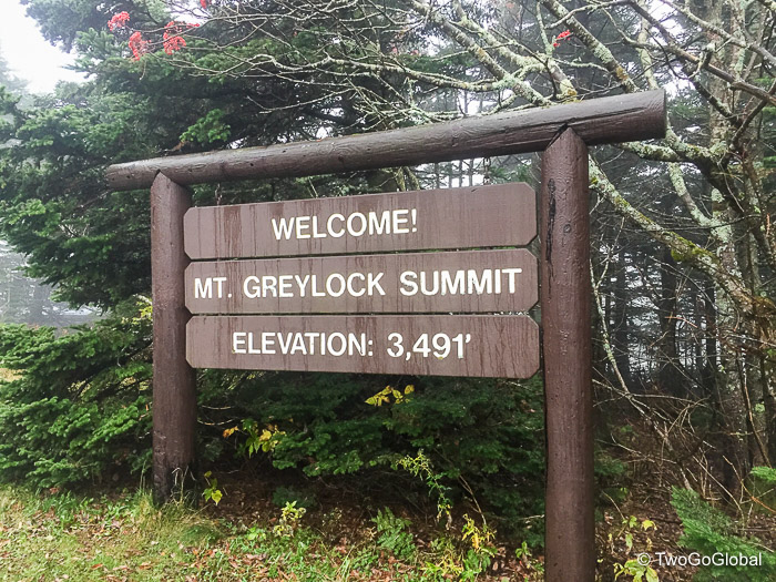
Altitude: 3,491′ ● Summited: 10/29/17 ● Route: Up/ Down: Drive-up
Already assuming that the 100% crap weather forecast was correct we had a backup plan, so instead of heading off to hike the Connecticut highpoint we decided to do a couple of drive-ups. Neither really taking us out of the way. Mount Greylock was 85 miles north of our Millbrook, NY, motel and on a good day would have made for a very pretty drive – today was not that day!
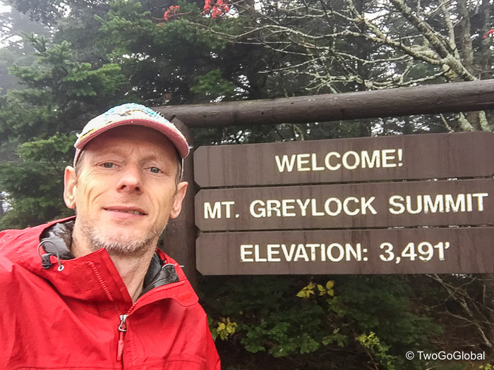
Mount Greylock State Reservation was our final destination, home to numerous outdoor activities, a section of the Appalachian Trail, and the Massachusetts highpoint. All we cared about on this miserable day was getting our photo in front of the War Memorial tower.
Upon entering the park we had to drive a further 9 miles or so to the upper parking area, all on paved roads crisscrossed with countless hiking trails. Most of these trails displayed the hiking mileage to the highpoint – we really should have pulled over, put on rain gear and at least hiked the final mile or two to the top of Massachusetts. Instead we took the cozy option! We were the only car making the uphill drive along tree-lined Rockwell Road, the conditions deteriorating the higher we got. Our reward was wind and thick clouds that shrouded out everything beyond a few feet away!
We didn’t dwell and after the obligatory summit photos were heading back down towards our next stop in Rhode Island…
Rhode Island – Jerimoth Hill
Altitude: 812′ ● Summited: 10/29/17 ● Route: Up/ Down: Drive with 0.1 mile walk
Disappointed by the miserable weather on Mt Greylock we didn’t really care what the hiking conditions were like on this next highpoint. Being a relatively quick 64 mile detour off of our driving route to Boston, the behemoth of Jerimoth Hill was conveniently located and definitely worth not having to make a specific trip into Rhode Island for!
The rain continued on pouring for the entire two and a half hour drive along Interstates 90 and 395 before finally subsiding for the final mile to the small shoulder pull-in along Hartford Pike. That last mile of highway slowly ascended until we felt we could go no higher – we must have been really close to the dizzying 812′ elevation. From the unofficial looking parking area a quick dash across the road and we disappeared into the trees by a small trailhead sign indicating the beginning of the designated trail. Two hundred yards and maybe a few more feet of elevation and we stood at this very nondescript highpoint.
It wasn’t always so easy. Previously this was one of the toughest to attain, being on private property with an owner that was not so happy about highpointers walking across his land to notch another state! Now having public access made for one of the easiest, increasing our count to 29 out of 50.
Connecticut – Mount Frissell (Southern slope)
Altitude: 2,380′ ● Summited: 10/31/17 ● Route: Up/ Down: Mt Washington Road Trail
Whilst Mount Frissell and its 2,454′ summit is located in Massachusetts the Connecticut state highpoint is 74′ lower on its southern slope, not an actual mountaintop in itself. It is one of only three US state highpoints that are the highest point in a state but not technically the summit of the hill or mountain.
The initial plan was to hike this over the weekend, the weather unfortunately throwing a spanner in the works. Switching things around and leaving the Connecticut highpoint until after the wet weekend turned out to be the way to go; there was no easy drive up for this one!
After passing through South Egremont coming from the north we had a further 12 miles of scenic road before reaching the small parking lot signed for the NW Camp trailhead. This was pretty much halfway along the narrow Mt Washington Road that eventually connected with Salisbury, CT, to the south. The northern Massachusetts side was sealed with the occasional fancy property along the roadside whereas continuing on down after summiting the road had been replaced with a potholed dirt trail wide enough for a single vehicle. We had read online that the road is often closed off by a gate, presumably in the winter – this wasn’t the case today!
The 2.5 mile roundtrip hike immediately took us back into Massachusetts before scrambling to the top of Round Mountain in Connecticut, dropping back down to a saddle in Massachusetts, then climbing again to the top of Mount Frissell, before finally skirting around the summit and dropping down slightly to the highpoint of Connecticut. Less than an hour and a half and we were back in the parking lot with summit number 30 knocked off.
A fun hike and great views in every direction made this highpoint worth the effort in getting to it.
Delaware – Ebright Azimuth
Altitude: 448′ ● Summited: 11/2/17 ● Route: Up/ Down: Drive with a walk across the street
Britton Hill in Florida being the exception, this is the second lowest of the 50 state highpoints at a mind numbing 448′ above sea level. Conveniently located halfway between friends in Madison, New Jersey and Rehoboth Beach, Delaware, it made for a convenient and very brief stopover.
Four miles after exiting Interstate 95 our GPS instructed us to take the next right onto Ebright Road, upon which either altitude or the excitement of such a sought after highpoint made our hearts begin to race. Less than a mile later we spotted the sign, a sign that meant so much! We pulled into a community entrance, crossed the road and stood either side of the Ebright Azimuth sign. Tears began rolling down our cheeks. What a load of baloney!
Luckily we knew what to expect otherwise we would have been extremely disappointed in Delaware for such a nondescript marker. I guess with such a low point in a built up area there’s no reason to brag or make a fuss over nothing. For us this was number 31 and by far the quickest highpoint stop to a place we definitely will not be revisiting!
July 8th 2017 – July 15th 2017


