The start date of February 19th would be 6 months to the day that I’d had a hip resurfacing procedure, coincidentally a date the surgeon said I could be back at full activities by. I felt great so had no reason to think that the hip could cause me any grief. What did concern me was the total lack of any long distance bike training! The furthest I’d rode prior to having to return to England were a couple of 65km rides along the scenic road to Whangarei Heads – consisting of plenty of ups and downs which would definitely be the order of the day on the Tour Aotearoa. Whilst in England I managed an hour a day at the local gym on their static bike and a fair bit of hilly hiking, not something that I believed would set me up for 3000 kilometers! The only bit of reassurance I had was reading in the TA guide book about either doing back to back ten hour rides, or alternatively to get fit as the tour progressed – the latter had to work for me.
I arrived back in New Zealand a week before the start date and decided not to bother with training, just to get everything prepped and ensure that at least the bike would be in good shape! New tubeless tyres were fitted, a new chain, new brake pads, lights, suspension adjusted, and I embarked on a short quarter mile test run with all bags attached. I was happy with the setup although I hoped that getting used to the extra 10kg of unbalanced weight wouldn’t take too long!
Enough oatmeal for twenty days was bagged, powdered milk, freeze dried meals for the first few days, almonds and walnuts, far too much Infinit nutrition, almond butter, and tinned tuna, all distributed between the different bags. I was actually enjoying this! My biggest screwup was the new Abus lock I’d bought in England – I didn’t realise how heavy, awkward and completely unnecessary it would turn out to be.
A couple of days out I made sure that my mum could take me as far as Kaitaia, and from there a $20 shuttle courtesy of a local cape resident, Oli Lancaster, would provide transport the remainder of the way. It was reassuring to know that if everything turned to shit during the first few days in Northland at least I could be bailed out by family.
Lets do this…
Day 0 – Cape Reinga
Accommodation: Tapotupotu DOC Campground $8 NZD
Total distance: 0km
Day 1 – Cape Reinga to Ahipara
Accommodation: Ahipara Holiday Park $20 NZD
Days distance: 111km
Total distance: 111km
An unwelcome 3km gravel climb from the DOC campsite to Cape Reinga would begin this adventure, a notification to the leg muscles of a sign of things to come! Arriving at the cape totally shrouded in early morning mist, barely allowing a view of the lighthouse or ocean below, was not in the plan – the first of thirty photos that would be proof to the guide book authors that the route was covered in its entirety was of the lighthouse. It wasn’t long with assistance from the sun that the official photo was taken and the ride could begin in earnest.
This day would all be about the 80km of cycling along aptly named Ninety Mile Beach, before which there was a fun rolling hill ride to a wide stream flowing a few kilometers to the sea. Not sure pedaling through this brackish water and sand so early in the ride would do the bike any good! With low tide for the first 40km the hard packed beach was fun to ride on, after which heat, a headwind, monotony, and an incoming tide crept in causing the sand to soften. By the time the town of Ahipara was reached the bike and my body was thick with sand and salt water, good enough reason to down tools and take a well earned dip!
Dinner of snapper and chips, and a full amenities campground for night number one was just what was needed, the licquor store closing at 6pm was certainly not – no cold beer tonight.
Day 2 – Ahipara to Waipoua Forest
Accommodation: Waipoua Campground $15 NZD
Days distance: 125km (plus a 10 minute $2 ferry crossing)
Total distance: 236km
Rolling hills were going to be the norm, especially in New Zealand’s north island. Ups and downs took me through sleepy towns of Herekino, Broadwood, and the coastal town of Kohukohu, the latter having a great cafe worthy of a flat white stop. A lot of the small towns in this area had barely any infrastructure, mostly relying on whatever the gas station sold. To reach the scenic Hokianga Harbour costal towns of Rawene, Opononi and Omapere a quick ten minute $2 ferry was necessary, whisking a bunch of TA riders across the water and onwards following the harbour towards its exit into the Tasman sea. I had recently spent a week in Omapere with family, a great location with huge sand dunes, sunsets and flat SUP friendly waters.
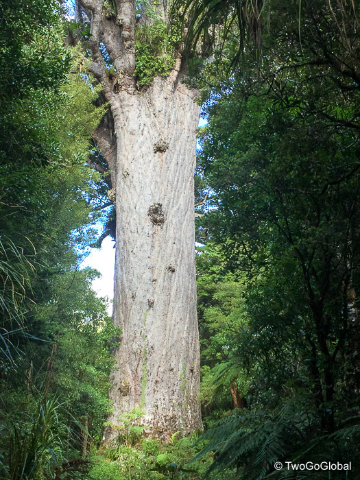
Continuing on, the next section involved much longer climbs as the ride moved into Waipoua Forest, home of the Tāne Mahuta giant Kauri tree. It was almost too much to resist when a Waimamaku resident said that camping was available in the church grounds, bang opposite a bar and fish and chip shop! As on many occasions a chocolate milk, steak pie and sprite from the local 4square supermarket would suffice – with a full stomach the ascent into the forest should be a breeze. Upward pedal stroke after upward pedal stroke, the next 7km ascended four hundred metres to photo stop three, the site of the worlds largest Kauri tree, estimated to be between 1250 and 2500 years old. A decent 10km descent was the reward for the biggest climbing so far, taking me to the beautifully located Waipoua Forest camping area.
The campsite offered kitchen access, a guided evening forest nature walk and for an extra $5, a cabin – with the following mornings condensation I should have paid the extra five bucks. So far I’m a happy cyclist with the bike going well, if only I could say the same about my ever sorer ass!
Day 3 – Waipoua Forest to Pouto Point
Accommodation: Pouto Marine Hall & Campground $15 NZD
Days distance: 123km
Total distance: 359km
Another pretty good 5km climb out of Waipoua Forest started the day, with detour options taking the route away from the sealed highway and onto roads less traveled. Whenever there was an option between sealed roads or typically more remote gravel roads the latter was always chosen. I had the far better setup for many sections of the TA, preferring a hardtail mountain bike with seatpost and handlebar bags over a fully laden touring bike with paniers and enough gear to support a full on assault! It ensured that there were no trails or bridges I couldn’t tackle.
Dargaville, the most populated town so far, was a great refueling stop before heading down the 68km long Pouto Road. After some confusion getting out of town I finally reached Aratapu Tavern, it was lunchtime and I’d missed out on a cold beer for the past three days – that time had come! A refreshingly cold Speights hit the spot and I was ready to tackle anything the road could throw at me, that is until the final 23km of miserable gravel road obliterated by the relentless logging trucks that flow in and out of the area. Fortunately it was mid afternoon and apparently the logging trucks have to be off the road by the time school finishes.
The road had its fair share of hills, most seemingly going up, with a bad camber. This made cycling treacherous, with barely enough speed to stay upright I would slide off the road into the gulley running alongside. To make matters worse it was miserably hot and my camelback was running dry! I rationed myself to a drink every 5km, a distance that never came soon enough. Eventually the turnoff to the logging area came and the gravel road surface improved substantially, then throw in a couple of sealed sections and the ride was back on track. Arriving into the remote Pouto Point felt good, even if it was nothing other than residential. On this occasion I chose not to camp and took a $15 dorm bed instead.
Day 4 – Pouto Point to Auckland
Accommodation: Totara Park $0 NZD
Days distance: 97km (plus a 3 hour 45km Kaipara Harbour boat crossing)
Total distance: 456km
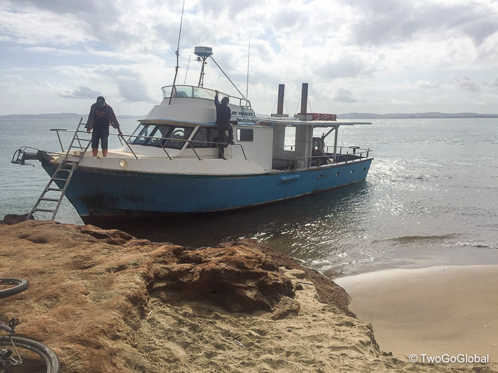
It was nice to have a lay in and not to have to tear down a wet tent – today was also the day when I met eleven other TA riders, all booked on a 10.30am charter across Kaipara Harbour, most on their own agenda. This saved a long bike around the huge harbour to Parakai. The boat with Shamrock charters left at 10.20am, a little earlier than scheduled, only to return minutes later to pick up two American kids yelling and waving on the beach – the skipper was not happy about turning around but in their defense they were on time. In the turmoil of getting bikes and bags down onto the beach to board the boat I’d cycled into the deep sand, only for the bike to fall sideways onto my attached helmet. Somehow the helmet got crushed between handlebars and the beach, destroying the foam in numerous places! I was none too happy as I knew it was now useless but would still have to get me the 54km to Auckland.
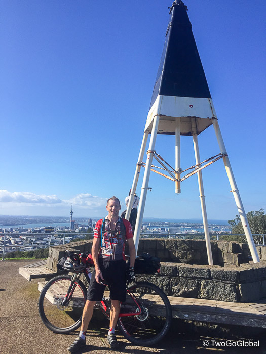
Auckland bound I again picked up a wrong turn and lost the cycle path I was meant to be following – this wouldn’t be the last time for sure. Maybe I should have gone with the better Garmin that allowed the loading of maps! Finally the last hill going up Mt Eden, an extinct volcano and Auckland’s highpoint, was navigated and positioned me for photo point five. Cutting it close but I also made it to Eden Cycles to purchase an overpriced cycling bib and butt cream. I didn’t care about the price as the misery outweighed any cost, and surely this could only improve my one and only problem so far! The store was also able to advise on a local hostel for accommodation as Auckland being a capital city was not cheap.
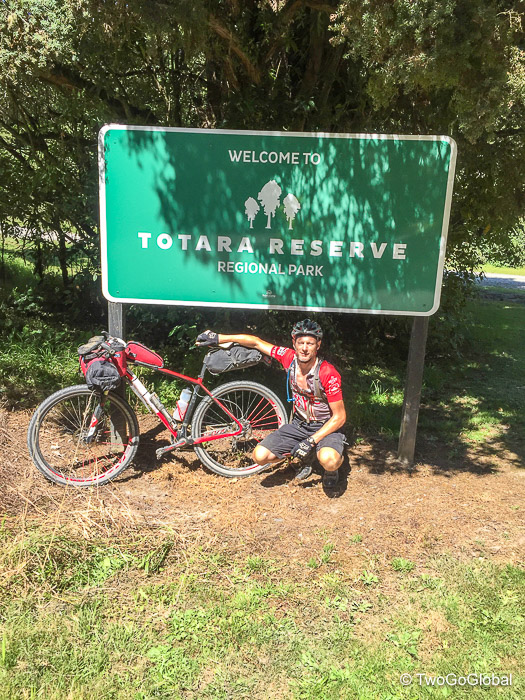
Turns out the hostel was full and with no cheap accommodation in the centre I headed out towards the airport where there too, all the motels were both expensive and full – after stopping for a beer and steak dinner I decided to keep on going through Manukau to camp illegally in Totara City Park, probably not the best idea but it was already 11pm. The next morning I discovered that this was a dodgy part of south Auckland to be cycling through and spending a night! This was verified with a group of noisy youths passing through at 12.45am, then again at 2.30am causing concern but no problems. A scrappy night sleep was ensured by the 6am fitness ladies working out 50 yards from the tent!
Day 5 – Auckland to Miranda Springs
Accommodation: Miranda Holiday Park $26.50 NZD
Days distance: 88km
Total distance: 544km
Due to the early morning and no real desire to get started the hunt for McDonalds or a decent looking cafe for breakfast began. It took a bit of cycling but a 12km detour bought me out at a great place to recharge devices and devour a full on breakfast – just what the doctor ordered.
There were two options upon leaving Auckland, one taking a coastal scenic road and a less busy, less scenic inland route. I opted for busy, even with my still broken helmet – turns out that even the $300 helmets were uncomfortable at the bike shop! As the cycling meanders further south it seems that most towns have at least one really decent coffee shop, prompting a flat white stop, often accompanied with a pastry pie of some flavour, a chocolate milk or smoothie, and if it happens to be later in the heat of the day, a can of sprite too. This was about the time that I noticed I was stuffing anything that takes my fancy down my throat, totally acceptable with the amount of calories being burnt! Clevedon was one such location, and this town also came with a well stocked farm shop – filling up on fresh produce was a rarity up to this point.
The route left Clevedon, heading along picturesque Firth of Thames and numerous small coastal towns, eventually leading into Miranda. By the time I pulled into the holiday park the heat had kicked up again, as it’s been doing everyday at around 4pm, making the desire for a cold one insatiable. Not all holiday parks stocked alcohol but this was my lucky day! An hour soak in their spring fed hot pool, a couple more beers, and a good nights sleep made for a very satisfying day.
Day 6 – Miranda Springs to Jones Landing
Accommodation: Jones Landing Campground $0 NZD
Days distance: 166km
Total distance: 710km
Up until this point an hour had not gone by with flat terrain – today this would change as the first 80km consisted of easy gravel cycle trail mostly following the Hauraki rail trail. This lead me through Paeroa, Te Aroha, and on towards Matamata, famous for being the gateway to Hobbiton. With many great cafes, including Bugger Cafe, Cheese Barn and Convenient Cow, en route this was going to be a fun day, a day to bang out big kilometres and get buzzed on caffeine.
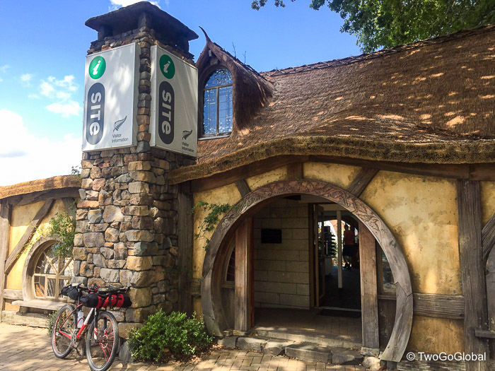
Heading to Matamata the nice cycle trail ended and was replaced with a sealed road, both into and out of town. Still pretty flat but with increasing tourist traffic the closer Matamata came. The obligatory iSite tourist office photo was taken before crashing out with a lunchtime beer.
With 119km under my belt it was time to push on to the next stop of Arapuni some 39km further on. A few kilometres out of town the trail reverted back to a flowing gravel track, soon changing again to singletrack along the shores of Lake Arapuni. The final 5km to Jones Landing lakeside camping was full of tight switchbacks and steep sections, made even worse by thinking that maybe I should have crossed the dam and been on the other side of the lake. Was this the start of things to come? Fish and chips at a roadside shack in the sleepy town of Arapuni ensured there would be no cooking tonight!
Day 7 – Jones Landing to Pureora
Accommodation: Ngaherenga DOC Campground (Timber Trail Start) $0 NZD
Days distance: 113km
Total distance: 823km
Today was a tough day of climbing, gravel, ruts, and a very sore ass! The first 54km to the town of Mankanini was mostly off road with plenty of ups and downs, including thirty seven tight switchbacks down to the Waikato River. This downhill section was pretty sketchy on a loaded and unbalanced bike. It was nice to enjoy lunch in Manganiko with three other TA riders I’d encountered on todays trail – once again I took in a concoction of chocolate milk, a banana, iced coffee, a savoury pie, all washed down with a cold beer. Looking back it makes me want to puke!
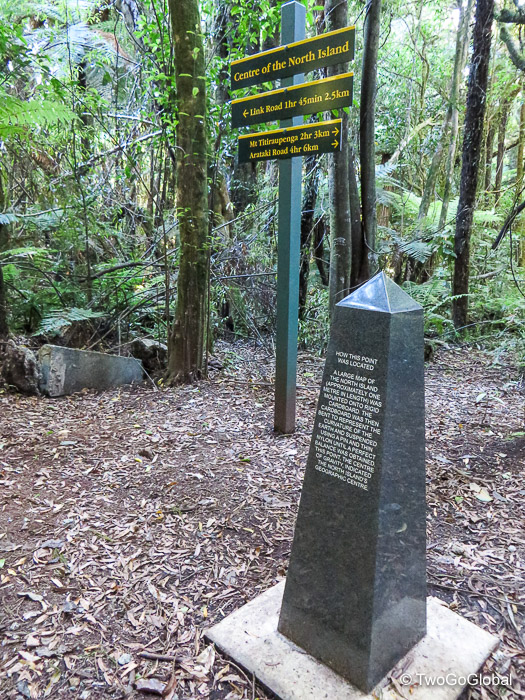
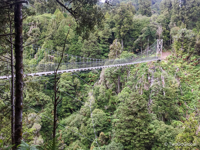
The second section leading to the beginning of the Timber Trail, one of New Zealand’s most popular off road cycle routes, was 49km, mostly on gravel and broken up 4wd track. An 18″ wide narrow wire bridge was thrown in at the start just for fun, involving having to lift the front wheel of the bike, hold on to the wire bridge for balance and push the bike – very sketchy. From there a narrow 4wd track went up, then up a little more, followed by a gravel road that also went up to make today the biggest ascent day at 7149 feet. A short detour on forest singletrack got me to photo point 8, the centre of the north island, but more importantly meaning I was halfway to Wellington! Finally the days riding ended with a fast 10km stretch of gravel, mostly downhill, to the Timber Trail DOC campground at Ngaherenga.
With lunch long gone out of my system it was time to finish the last freeze dried meal for two, for one in my case, with tinned tuna and tomatoes thrown in for additional calories. I certainly wasn’t going to go hungry eating like this! A cold shower under a tap and I was done for the night.
Day 8 – Pureora to Taumarunui
Accommodation: Kelly’s Motel $45 NZD
Days distance: 104km
Total distance: 927km
Today was the only day I had no GPS, something to do with no access to mains power! I either should have bought in advance a power pack or a dynamo hub for the bike. With an uncharged GPS I entered the timber trail at kilometre zero, initially climbing 400 meters over 12kms to the summit of Mt Pureora. I had no problem climbing for an hour to experience what was to come – 28kms of downhill singletrack flowing and curving perfectly through the forest. Definitely need to return with an unloaded bike! With good has to come bad and at the halfway point I suffered from a broken rear spoke, not too much of a problem if it stays at only one.
The next 42km was a mixture of gravel, single track and a 3km climb, before becoming a fast and rutty downhill. Not quite so enjoyable with thirty one spokes and a cycling shoe cleat with only a single screw! I was having to remove a shoe at each bridge crossing due to not being able to unclip from the pedal. Eighty kilometres is a long way when the terrain is mostly dirt singletrack and it felt good to finally get to the parking lot in Ongarue.
The next 25kms to the days overnight stop in Taumarunui felt long and never ending, especially without a cycling computer. I had decided long before getting into town that a motel bed would go down nicely tonight, and with Kelly’s offering a two bedroom apartment for $70 it was too good to refuse. Sleeping in a bed was going to feel revitalising! Taumarunui gave me the chance to stock up on food, discover a very refreshing Macs lime & chili cider, launder clothes, wash bike, and have all my gear spread everywhere.
Day 9 – Taumarunui to Pipiriki
Accommodation: Whanganui River Adventures Cabin $25 NZD
Days distance: 107km (plus a 32.5km jetboat ride)
Total distance: 1034km
It’s not so much fun having to try and avoid potholes, ruts and rough road surfaces – the price I now have to pay for being a spoke down. Turns out that from the first 67km I had to endure, 52km of it was rough gravel, terrain that was guaranteed to cause me a second broken spoke. Now I was concerned as the wheel was gradually becoming weaker and more out of alignment! Todays big climb was steady, followed by almost 40km of mostly downhill into Whakahoro and the perfectly located Blue Duck cafe. From here I was able to call a bike shop in Whanganui, the next town on my route south, to make sure they had the correct length spokes.
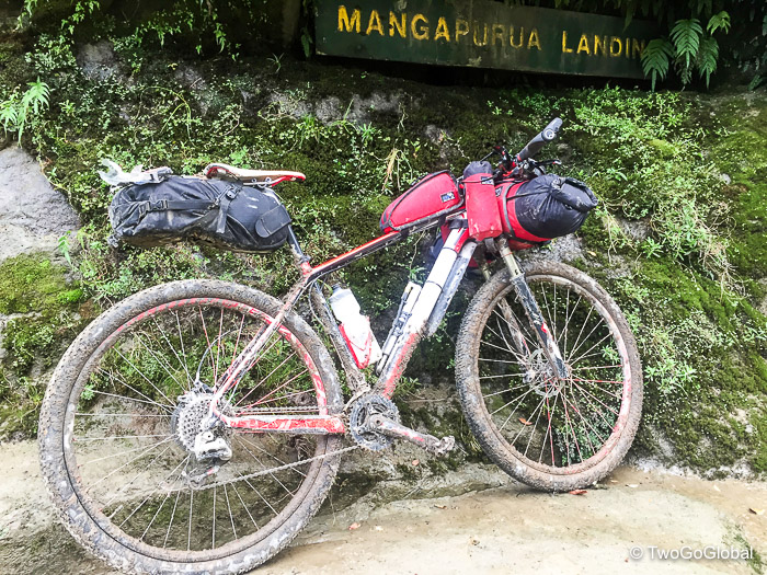
To take my mind off of the next hellish section I demolished a plate of tasty lasagne, washed it down with coffee and sprite, briefly pausing to contemplate the stupid decision I was making about not getting the bike repaired before hitting this trail. Continuing on regardless of the outcome the days big concern was 40km of muddy single track and 4wd trail to Mangapurua Landing, a remote end of the line trailhead with onward travel only possible by kayak or jetboat.
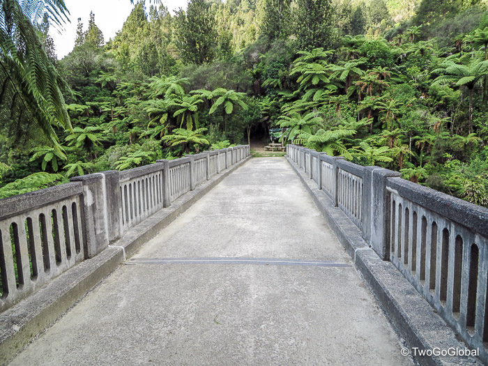
Initially I took it real easy avoiding all ruts, applying limited pressure through the back wheel, and anything that might cause busted spoke number three. A fellow TA rider took a rib breaking fall on this gnarly section last year and I could totally see why. Muddy pools of water were scattered along the first 10km of the overgrown trail, most showing no indication of depth until the front wheel was bogged down. The bike limped through, continuing on with 10km more climbing on easier trail, followed by 20km mostly downhill, with the final 10km back through muddy pools and narrow single track. Just prior to reaching the landing came the Bridge to Nowhere, a concrete bridge built across the Mangapurua Gorge – now a tourist attraction. Road access was abandoned after the area proved to be so remote and unsuitable for farming that the venture failed.
As planned the old drab looking jetboat provided by Whanganui River Adventures was waiting at the wooden pier, alongside a fancy yellow beast of a boat for the river daytrippers. Ninety bucks was a bit on the pricey side for the forty minute transfer to Pipiriki but turning around and heading back to where I’d come from was not an option! The company also had a cabin and kitchen access available at the departure point so it was an easy decision to call it a day. I was very happy that the bike had come through unscathed!
Day 10 – Pipiriki to Hunterville
Accommodation: Vinegar Hill Campground $0 NZD
Days distance: 147km
Total distance: 1181km
The route from Pipiriki to Whanganui was a mere seventy seven kilometres, the final stretch of gravel keeping me from a fully functional bike. All I needed to do was three and a half hours of careful ‘pothole avoiding’ riding and hope that the bike shop had the correct spokes for the job!
Being out early morning following the Whanganui River and canyon in low cloud made for a relaxing ride. Then came the bustle of a busy town – I arrived on a day of Maori celebrations, something to do with a 79 day land dispute back in 1995. The bike was lovingly repaired at Velo Ronnies for a bargain $54 and had me on my way to Hunterville. On the way out of town photo point eleven involved a ride on the ancient Durie Hill elevator located 100 metres inside a tunnel – this bought me out to impressive views over the city and the road on which I’d be leaving town. Sixty kilometres of sealed road later in Hunterville I debated taking a motel room, then got distracted by a well made flat white, closely followed by ice cream and a bottle of cider.
The offer of a tent in someone’s garden couldn’t stop me from moving on and I headed out of town for a 20 minute ride on busy highway 1 towards Vinegar Hill campground. Good cell phone connectivity allowed me to make a reservation with inter island ferries for a 5pm Friday crossing from Wellington to Picton. Not bad for $73 including a bike. I now had a goal and was excited at the thought of the south island being only 3 days, or 390km riding away!
Day 11 – Hunterville to Palmerston North
Accommodation: Ambassador Motel $99 NZD
Days distance: 131km
Total distance: 1312km
A few pretty good hills were undertaken today, made significantly harder with the ball bearing gravel roads, especially bad from Apiti to Ashhurst. Going downhill with a fully laden bike seemed more challenging as it continually felt like the wheels were slipping from under the bike. Ignoring the hills and road surface the views have been relentlessly good no matter which direction the road takes me. Due to heavy logging everywhere throughout New Zealand large patches of trees are few and far between but the farmland and open hilly countryside is spectacular.
Almost on par with the road surface was rolling into Apiti at 11am to find the newly refurbished tavern doesn’t open until 3pm. Four hours was far too long to wait! Its amazing how people live in these very quiet towns, some with no conveniences at all. Ashhurst was slightly bigger and welcomed me with an Indian run shop with the owners insisting I buy a pastry pie, loaded bread roll and a sprite. I need to kick these habits after the ride, especially the sprite – fizzy drinks are something I never usually touch!
Palmerston North was my goal for the day, and with a short and sweet final 21km it would bring my mileage for the day to 132km, 1312km in total. Rolling into town along the river on a hot as hell afternoon all I could think about was how nice it would be to jump in a cool pool. I’d found just that, a reasonably priced motel on the main road into town with a pool. I couldn’t wait! The manager must have thought I looked beer deprived as he handed me a nice cold one with the room key.
It’s always a good day when I manage to do laundry, dry everything, shop, get nutritional resupply and a good nights sleep.
Day 12 – Palmerston North to Martinborough
Accommodation: TA Riders House $0 NZD
Days distance: 161km
Total distance: 1473km
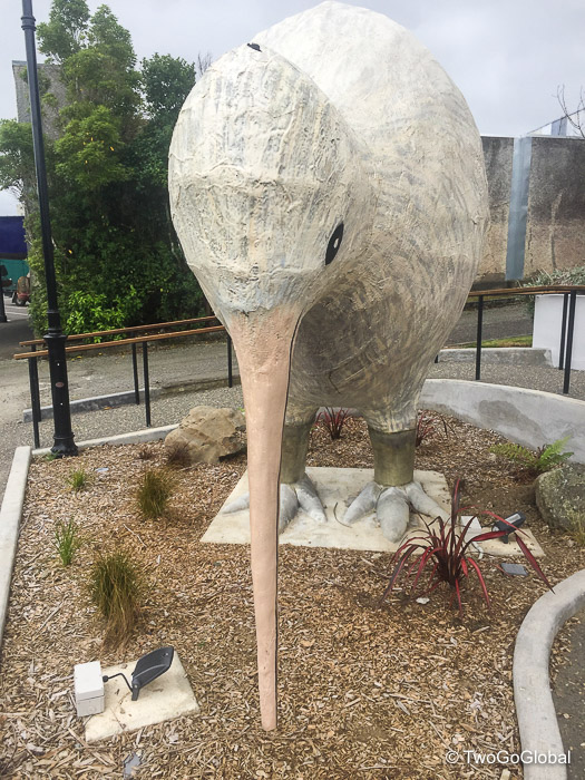
Another one of those short sharp hills took me out of town, the early hour making it feel like a real lung buster! Instantly it was followed by a 10km steady climb. A decent gravel road and cycle path took me into Pahiatua and a coffee stop where I bumped into a couple of Aussie TA riders I had not yet met. The three of us then pushed the 35km at a fast pace to Eketahuna and photo stop number thirteen of a giant kiwi.
The day was mostly overcast with a rare slight sprinkling of rain. It was good to have something other than sunshine, something that would keep the temperatures down a little for the long day ahead. This area in the south of the north island was becoming more populated, with Masterton offering bike shops and anything else I may be struggling to find. I had been after a selection of spare spokes to take down to the lesser populated south island but so far nothing had come up – the bike shop options in Wellington is far greater so hopefully the availability will be better.
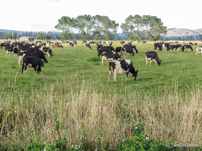
The entire ride to Masterton was offering lots of cows as usual, lots of up and downs as usual, lots of farms, and very little vehicular traffic. This was to be the penultimate stop, a bigger town famous for its sheep shearing. My arrival around lunchtime meant only one thing, that it was time to eat, so as I usually do I stopped at the first decent looking cafe. Splurging on whatever takes my fancy was becoming a habit – the only way I justified it was to tell myself that accommodation is only averaging out at $20 a night so I can afford to hit it big with food!
Once again I cycled a couple of kilometres the wrong way along the correct road before realising that I wasn’t seeing my turnoff. It was good that the 49km to Martinborough was predominantly downhill. Once there I had all the creature comforts of another TA riders empty home whom I’d met at an earlier date. Time to settle in, do laundry, get the bike clean and oiled, and take a hot shower, after all this had been a 160 kilometre/ 100 mile day. Martinborough itself was a nice little town in wine country with busy restaurants and a pretty central square. Thanks John Taylor for the accommodation.
Day 13 – Martinborough to Linkwater (South Island)
Accommodation: Smiths Farm Holiday Park $16 NZD
Days distance: 119km (plus a 2.5 hour $73 Inter Island ferry across the Cook Strait)
Total distance: 1592km
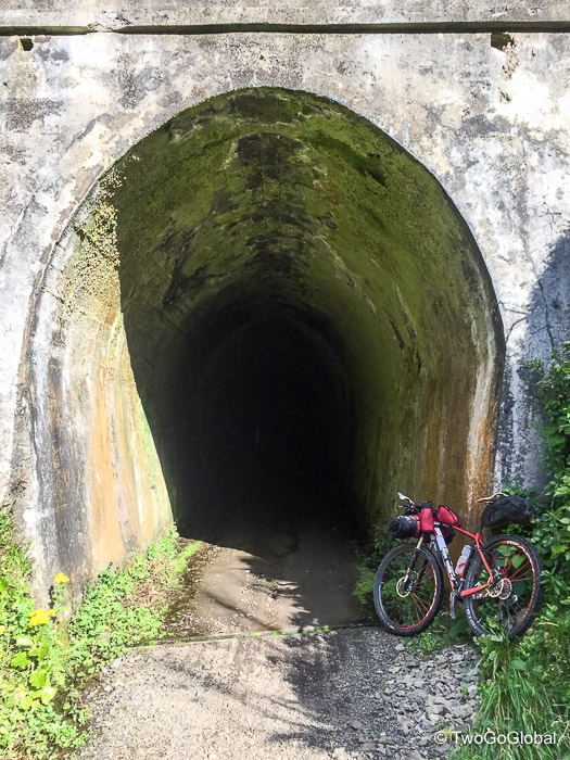
This was to be my final day in the north island! An early start was anticipated in order to make Wellington in time for the bike store and ferry crossing – I had no idea what the 100km between Martinborough and Wellington would throw at me. Turned out to be an easy ride towards Te Marua until the start of the Rimutaka Cycle Trail. A steady 7km climb on dirt trails through old pitch black railway tunnels and lush green hillsides made this seem very remote again, as does much of this ride when not on highways. Twenty kilometres almost entirely downhill then took me into Te Marua and an appointment for Devonshire tea and scone with jam and fresh cream.
I thought the hard work was done and that the final 44km to Wellington would be fast sealed road – guess I should have paid more attention to the guidebook. The graph showed a comfortable downhill all the way! It began with some awkward singletrack along the Hutt River which I could tell was going to take a while. After the first 8-10km it fortunately turned into a nice fast gravel cycle trail, and finally a paved trail the closer I became to Wellington. Riding into this city over riding into any of the previous ones was that the ferry terminals were on my side and I didn’t have to try and work out a route to the other side, something that I didn’t enjoyed one bit.
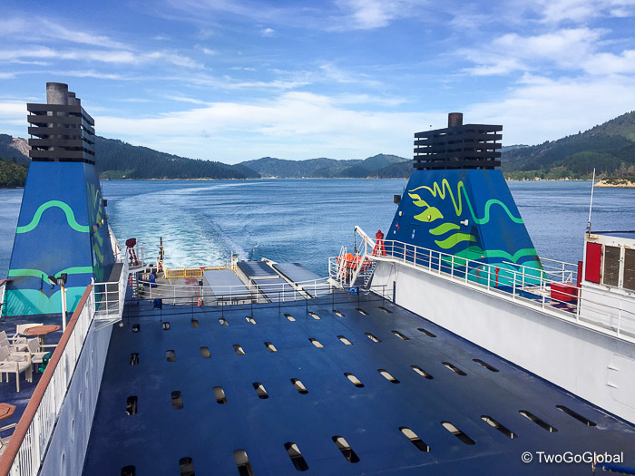
Having made the iride bike store by 1pm, purchased a handful of spare spokes and had lunch I decided to change the ferry departure from 5pm to 2.45pm. Having daylight on the south island for 20km from Picton ferry to Smiths Farm campground made far more sense than riding in the dark, and anyway I had no desire to venture into Wellington’s CBD to waste time. I said my goodbyes to the north and enjoyed the calm crossing with Inter Island Ferries.
A couple of decent hills went almost unnoticed as I cycled along the scenic Queen Charlotte Drive passing the quaint Whenuanui and Ngatuka bays. I arrived at Smiths Farm campground to a warm muffin and proper fluffy towel. One of the things I’m discovering more of the further I cycle is why I didn’t do this or take that road – the question here was why I hadn’t detoured out of Picton on anther local ferry to complete the nearby Queen Charlotte Track. I had barely even heard of it until this point! I now have at least one good reason to return to the south island.
February 18th – March 3rd 2017


