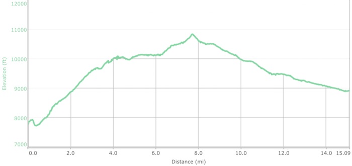
September 8th 6.49am: Muir Trail Ranch to Bear Creek Jct
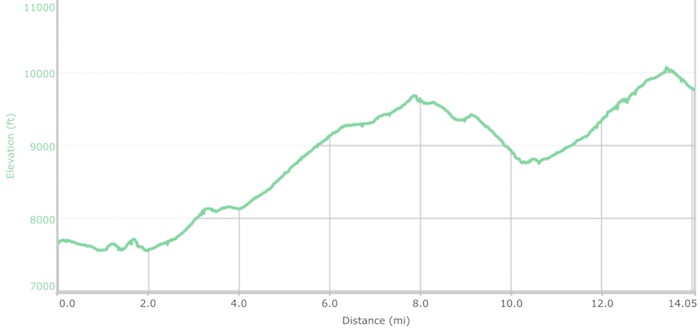
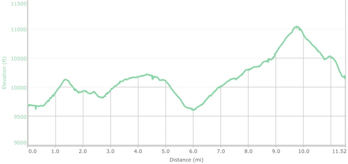
Mileage: 14.63 ● Elevation Gain: 4,369’ ● Total Mileage: 127.93 ● Total Elevation Gain: 34,872’
Departing our elevated campsite at Muir Trail Ranch with another full quota of food looked like it was going to be a repeat of day 1 from Whitney Portal. Similarly we also started with an instant half mile steep climb to rejoin the JMT. Fortunately with this being our eighth day of continuous ups and downs our legs were able to cope far better with the additional load.
Beginning at 7,650′ today was our penultimate climbing day, Selden Pass being the leg grinding culprit. Although 1000′ lower than the previous climbs it should have been easier, or at least that would have been the case if we hadn’t started significantly lower than every other day. Departing from Muir Trail Ranch we were straight into steep terrain, terrain that offered no initial warmup – age welcomes nice warmups!
After half dozen long switchbacks we eventually reached Senger Creek, the trail becoming mellower as it passed by the picturesque Sallie Keyes Lakes and on to aptly named Heart Lake. A dunking was only a matter of time with the slippery logs that typically enabled hikers to cross creeks. Luckily no harm was done as I took my first log slide into the Sallie Keyes Creek inlet!
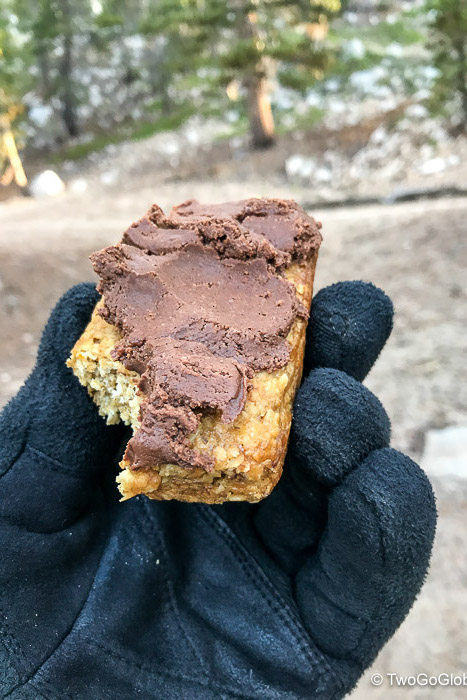
Despite heavy packs, being able to eat like pigs now that we had so much food was an excuse to stop more frequently. We now only had to survive 3 days until reaching civilization at Red’s Meadow, bringing with it a fully loaded store, a food joint, and dreaded people. Throughout the first half of the John Muir Trail I had found it hard not to dip into our stash on a whim! Even worse was knowing that our resupply provided us with Justins Hazelnut Chocolate spread, delicious at the best of times, totally orgasmic on a long hike like this! Let the eating begin…
Andrea stated: ‘Justins Hazelnut Chocolate spread is the bomb and Tang is my vino’.
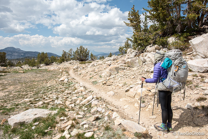
Feeling revitalized after our rest stop we pushed on, soon passing by 3 seventy something ladies, Andrea saddened with the fact that her mum’s golden years were stripped away due to Alzheimers. We continued to come across lone girls in their 20’s too, neither of us having done anything like this so young but full of admiration for their gung-ho attitude.
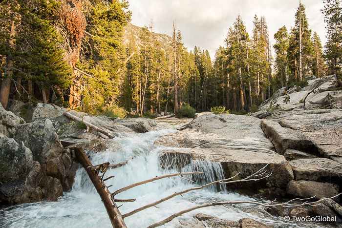
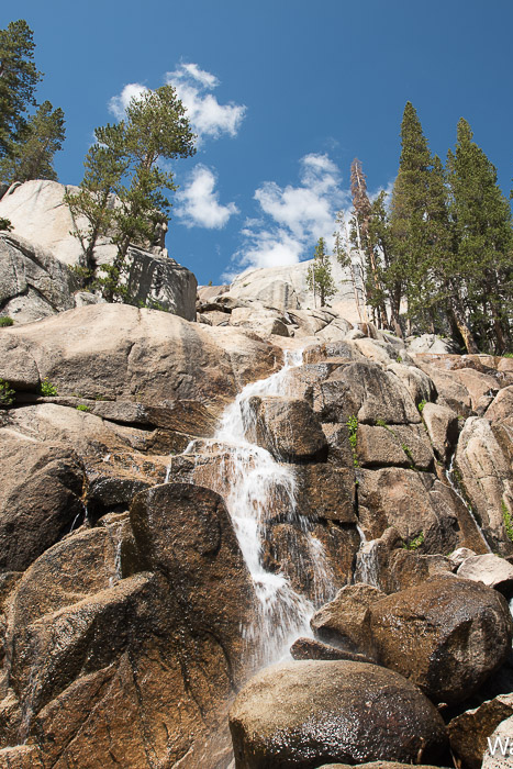
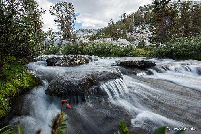
To numb the incline the hike up and over the pass in glorious weather was another stunner with fluffy clouds, lakes and wildflowers visible everywhere. The day still felt like a long slog, Andrea commenting that fourteen miles wouldn’t have been so bad if she wasn’t wiped out after the first twelve! I think we both counted down the last couple of miles to our Bear Creek campsite. Beyond the pass the welcoming sight of Marie Lake and its stunning backdrop got us into a good stride, interrupted occasionally by broken terrain making for awkward footing and slowing down progress. The trail soon flattened out nicely and we ended up following a cool flowing creek with cascades and some interesting water formations the rest of the way to our Bear Creek camping spot.
Located up a small incline from the creek we found a great place to pitch the tent, the sound of flowing water helping us to doze off, and one of the best sunsets we witnessed during the hike. The skies transformed into amazing shades of reds and burnt oranges, illuminating the waters of the creek and making for a perfect backdrop – a precarious camera balancing act on the creek bank was necessary to overcome not carrying a tripod.
Hopefully balancing our ‘not so bear proof’ odor-free bag in a nearby tree won’t cause us problems tonight.
- Love seeing all the solo girls – we admire them
- Another refreshing dunking in cold river
- Time flies and we can’t believe we’re down to 95 miles remaining
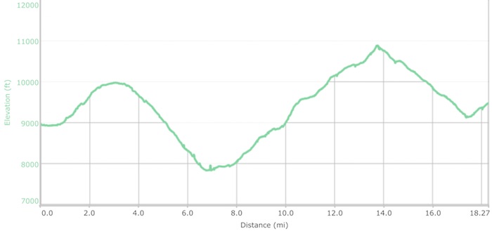
September 9th 6.11am: Bear Creek Jct to South of Tully Hole
Mileage: 17.66 ● Elevation Gain: 5,391’ ● Total Mileage: 145.59 ● Total Elevation Gain: 40,263’
Don’t think this applied to me too but apparently Andrea had her best nights sleep so far, optimistic that she could repeat it for the remaining days. This certainly didn’t mean that getting out of bed at 5am was easy for her – she had been relying on me to be up and about, preparing and cooking breakfast, every day thus far and things weren’t about to change today! It took intervention to get her out of a snug sleeping bag.
On the march by a bright and early 6.15am we were thrown immediately into a 1000′ incline up to Volcanic Knob Trail, a climb that didn’t make much of a dent into our 5000′ day! What it did was lead nicely into a moderately downhill forested section where we expected to come across elves and hobbits in the early morning solitude. This went on for 5 miles, leading us zigzagging down an endless trail of switchbacks before finally reaching the turnoff to Thomas A Edison Lake and Vermillion Valley Resort. A short ferry ride across the lake would have taken us to what is known as VVR, another location for resupplies and spending a cushy night with a beer or two. Due to VVR having road access we started noticing far too many two legged creatures milling around the various trails, this prompting us to continue with haste upwards towards Silver Pass.
The long seven mile 3000′ incline up to the pass reminded me a lot of what was to come in Yosemite, with awesome mountain views, water cascading over smooth slabs of rock, and areas still covered in snow from a lingering winter. Around halfway into the ascent we came across a section of huge boulders alongside a creek crossing, almost a perfect place to get out of the hot sun and devour our long-awaited lunch of loaded wraps. This was typically the highlight of our day and knowing that we get to eat chef prepared food at Red’s Meadow and Tuolumne Meadows allowed for us to feast on the contents of our bear boxes now. Unfortunately lunch barely prepared us for the steep section that was to come!
Totally exposed we were now walking in the heat of the day, probably the hottest day we had so far which went hand in hand with the biggest incline gains. Putting one foot in front of the other it didn’t seem too long before we crested what we thought was the lowest way through the mountains to our Squaw Lake campsite. This wasn’t our first false summit and wouldn’t be the last! More sections of late snow and a couple hundred vertical feet would see us to the true pass. The weather had now turned overcast, we were both spent, and ahead of us was 1700′ of down! We did have stunning mountain views in all directions to numb the knee pounding descent. This was already a long-ass day and was about to get worse.
We had planned on stopping at Squaw Lake but due to the reasonable hour decided to continue on just a little further, a big mistake for a few reasons; Squaw Lake was a pretty cool place to camp, the next campsites were almost 3 miles further in shaded wooded areas beyond Cascade Valley, and soon we would be heading back uphill again. Other hikers had told us about cool mosquito ridden campsites just along the trail – we should never have listened! Onward we went…
After 17.5 miles we finally said enough is enough and pitched our tiny tent in a clearing across from Fish Creek – Andrea was DONE and I wasn’t too far behind. Fifteen had been our target for the day and with 18 more tomorrow we were eager to get in some much needed downtime.
The weather had turned fickle temporarily ruining my creek bath, Andrea having no such problems – she preferred to take a wet-wipe wash in the tent instead of enduring the chilly creek. I had to lounge around outside listening to her complain about strange bites or sun poison on her finger, how she had been trying really hard to keep up with the sunscreen, that there was so much dirt on the trail and how filthy she had become, and that it was now raining in camp! Whine, whine, whine. We did get to enjoy another of her very well prepared chicken couscous dinners, and I eventually did get to actually swim in the creek.
Today had been a grind and with lots more elevation to come it was not yet over – 11,073′ Donohue Pass at the Yosemite National Park boundary would be the final significant climb.
I continue to be super proud of Andrea and her ability to haul her pack up and down these hills, day in, and day out.
- Exciting 18 miler tomorrow for burger and beer at Red’s Meadow
- Starting to feel closer to civilization!
- Only 77 miles left – we’re not looking forward to the end
- Today was the biggest elevation day of the entire JMT
September 10th 6.26am: South of Tully Hole to Red’s Meadow
Mileage: 18.59 ● Elevation Gain: 3,167’ ● Total Mileage: 164.18 ● Total Elevation Gain: 43,430’
Beginning with a repeat of the previous day, starting something like this… Wake Andrea, prepare breakfast and hot drinks, ask Andrea why she’s not up yet, tear down camp, then head off immediately into a 1000′ climb towards todays highpoint, Lake Virginia. Andrea was already complaining about sleeping crap, waking up with a sore neck! All whining aside, we had to get cracking as the thought of burger and fries at the end of 18 long miles was almost overwhelming.
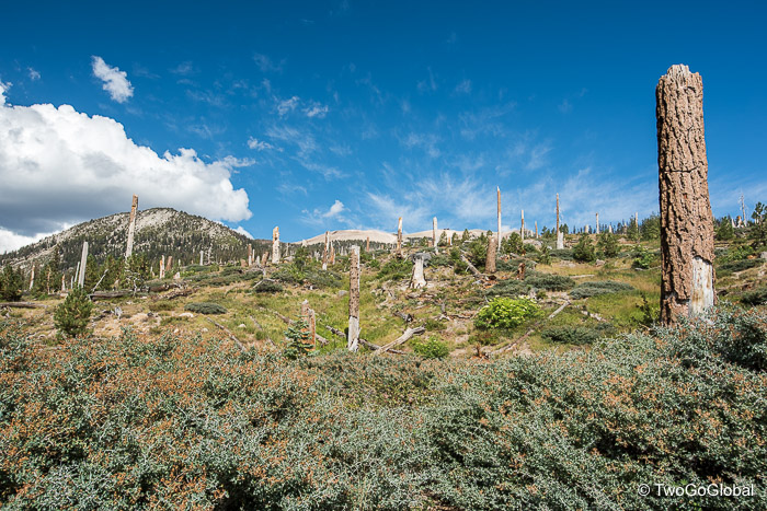
The hike was steep and fun up to Virginia Lake, pretty much the calm before the storm. What followed was a very long 12 miles of sandy, boring downhill to Red’s Meadow, the first 6 between Duck and Deer Creeks having no water access. The terrain should have been easy but at times the relentless sand made for a miserable slog. To make matters worse the final couple miles into Red’s Meadow were hot and unshaded, bought on by the remains of stunted trees everywhere. It was sad to see what happens to the forest from natural disasters – huge swaths decimated after prior destruction from fire and wind. We certainly didn’t envy hikers heading south out of Red’s Meadow!
First there were horses, then a few cars, finally people, all telling us that we had re-entered the civilized world. Eleven days off the grid had gone by since we left Whitney Portal and these were scary moments! Seeing the burger joint and showers reversed all the negative thoughts we temporarily suffered from.
The campsite was okay, below what we expected for $5 more than we had paid for every other night so far, but we had other things on our minds. After turning down a somewhat hefty cabin and shower option, we, or should I say Andrea had no problems coughing up $7 for a shower – I paid reluctantly! I had enjoyed my evening creek bath but the thought of hot running water was too much to resist. It’s a pity that we’re now so clean and our clothes that we have to put back on are so dirty and thick with forest dirt 🙁
Today had been a mundane kind of a day with the sole target being large portions of burger and beers. Although not disappointed, we had both really enjoyed our pre-packaged dinners so burgers didn’t wow either of us particularly – it was nice to have someone cook for us though. Afterwards Andrea did exclaim Yikes at the $49 price tag for burger and apple pie a la mode!
Dinner and showers out of the way we were both exhausted and decided that no alarms would be waking us in the morning – we were sleeping in, hopefully past 6am. Whilst Andrea crashed I decided to take the quarter mile walk back to the Red’s Meadow store to grab one last large beer, a little extra to aid with a good nights rest.
- Ran out of hazelnut chocolate spread today, after 3 measly days
- Still loving the less popular northbound direction
- Only 2 days remaining and we’ll be in Yosemite National Park
- Hurricane is hitting Florida – so strange to be away from the news
September 11th 8.12am: Red’s Meadow to Garnet Lake
Mileage: 13.59 ● Elevation Gain: 4,516’ ● Total Mileage: 177.77 ● Total Elevation Gain: 47,946’
It was great to be back on a high after yesterdays low-key day, eagerly beginning with a cooked breakfast of eggs, potatoes, toast and an endless supply of coffee, tea and WiFi. We knew there was a good reason we had stayed at the Red’s Meadow campground. Being able to glance at Facebook and Email was something we realized we weren’t missing at all, even Andrea commented that she had no desire to find out what was going on at work!
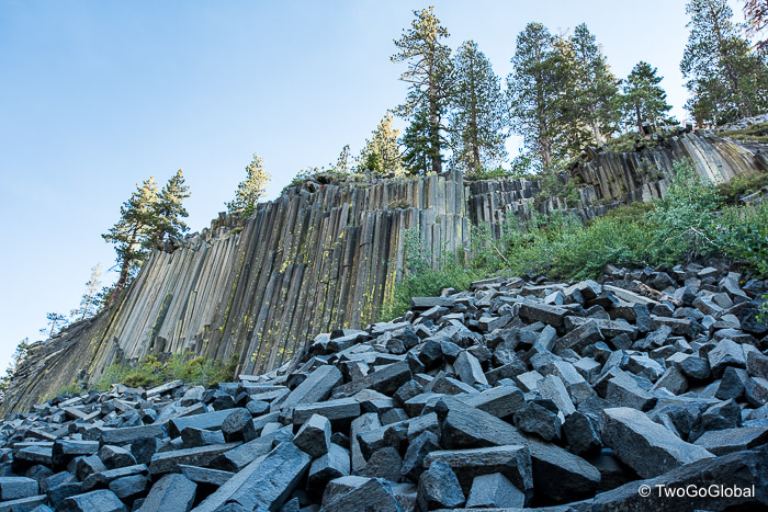
Today saw our second detour of the JMT so far, a minor route adjustment to go visit the Devils Postpile National Monument. Neither of us being into geology, we both agreed that although it didn’t add too much more distance it was still a waste of leg power. We were now comfortably ahead of schedule and could stay well within our initial daily mileage of just below 13 miles – easy days ahead. This also meant we could spend more time enjoying the days quota of lakes, culminating with the stunning Garnet Lake.
Each having their own beauty, we passed by scenic Trinity, Gladys, Rosalie, and Shadow Lakes on our way up and over the days 9,700′ highpoint. For some reason the long and steady 2,000′ climb out of Red’s Meadow felt barely noticeable; maybe we were finally acclimated to banging out ups and downs, day in and day out. Lunch sitting on a huge boulder at Rosalie made us realize exactly why we were out here doing something we love! Today was definitely a welcome change from the slog of yesterday.
A dozen fun switchbacks took us from Rosalie on down to Shadow Lake – nestled in amongst trees we skirted the lake before the days second and final ascent, this time with inclement weather to deal with. The skies had darkened, soon followed by distant thunder and lightning. All of a sudden it was no longer distant causing us to get kitted out in waterproofs and get up close and personal to the biggest tree we could find! We only had a couple of miles before reaching our planned campsite at Garnet Lake, almost looking unreachable in the thunderstorm we were caught up in.
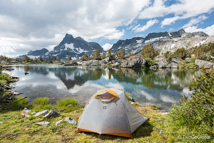
Definitely feeling like we lucked out by not setting up camp prior to reaching the lake, the conditions improving just enough for us to start hiking the final uphill section. The remnants of the storm had bought out some impressive colors and lighting, shown off as we passed by a small tarn at the crest of the incline. Garnet Lake was high on our list of most beautiful lakes so far! …and we managed to squeeze our tent into a perfectly placed site just above the shoreline, complete with amazing views.
The day had transformed itself from great to crappy and back to great again, improved further with Spicy Kung Pao for dinner and getting to actually swim in the slightly warmer lake. Still being well ahead of schedule we turned off alarms for tomorrow and dwelled on the fact that we’ll be in Yosemite tomorrow, another big step closer to the finish line.
Andrea’s comment of the day…
“I had a snickers for a treat tonight and it was yummy – I’ll get another at Tuolumne Meadows and some Gummies!”
- Day 12 and only a single pile of bear scat
- Solar panels were the way to go for charging our small stuff
- Andrea wants to reiterate how good the Snickers bar was!
- Second day of no poop, but twice yesterday; Andrea’s quote, not mine
- Bear boxes still seem full but we will devour for sure
- Andrea doing awesome – so very proud or her endurance
September 12th 8.01am: Garnet Lake to Upper Lyell
Mileage: 11.12 ● Elevation Gain: 2,916’ ● Total Mileage: 188.89 ● Total Elevation Gain: 50,862’
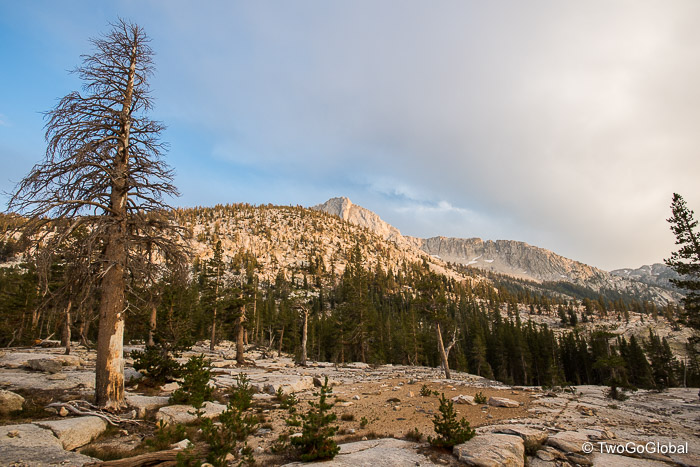
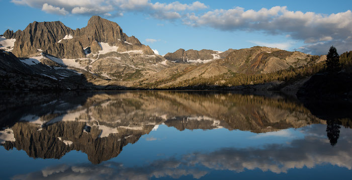
With the air cleared by an overnight thunder and lightning storm today’s weather ensured we began this new day in the same vein as the previous one, the sun coming out over a calm Garnet Lake providing a perfectly illuminated reflection. I at least slept well, not so sure about Andrea though after listening to her complaining about having a sore neck for the second consecutive night – nothing that the warmth of the day can’t fix! We have now been hovering above 10,000′ since day one, barely affecting our sleep, and enabling our lungs to efficiently cope with the continuous ups and downs. The hiking had become considerably easier over the duration, today being a long, short kind of a day with a small Donohue Pass and a little over 11 miles to contend with.
Our days hiking began with a cool trail along the shoreline of Garnet Lake before making a 500′ ascent to arrive at what some say is the best of the best lakes on the hike, Thousand Island Lake. I agree that in perfect weather or with a good sunrise or sunset this would have a big wow factor but with the sun now obscured by clouds it wasn’t so stunning for me – maybe to appreciate it more we should take a rest day and spend the night at the waters edge.
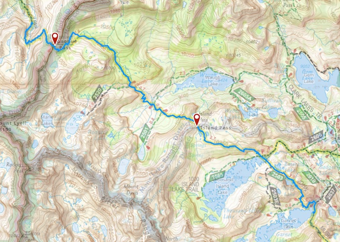
Another 400′ of elevation and a couple miles beyond Thousand Island Lake we arrived at a nondescript Island Pass, almost unaware that we had even reached the top of a pass. Now that we were both fit as fiddles and carrying lighter loads surely it would be an easy 5 miles and 1500′ of up to the final pass – if only! What we assumed would be plain sailing turned into a real grind, both of us totally underestimating the winding trail up to Donohue Pass. We had made it to Yosemite National Park. Now would the weather hold out for us?
Turns out the entry sign to the park was a perfect place to rest, recuperate and devour one of our classic lunches. As usual the surrounding mountain views were amazing, the Yosemite highpoint of Mount Lyell being a good reason to pay a return visit.
Descending down into Yosemite we skipped on passed a potential camping area perched right on the edge of a small tarn with views down into Lyell Canyon, probably for the good as we ended up at another small lake at Upper Lyell. We had dropped 900′ to leave us spending a chilly and windy night at 10,200′. The weather had been good to us all day but as soon as the sun dipped behind the peaks things changed dramatically!
Andrea agreed that our campsite was probably one of the best we’ve had, ‘almost’ no one passing through deciding to join our oasis, jagged peaks overlooking us, and the sound of flowing water heading down into Lyell Canyon. We loved it here. For a change I skipped on washing, instead preferring to take photos of the water exiting down valley from the lake – Andrea made up for me and got wet in the freezing water, and then goes on to complain about still feeling nasty!
We’re now down to a mere 34 miles to the finish line at Happy Isles, our transportation not leaving until 5pm on day 4 – we have a lot of time to kill, and almost wished we hadn’t pushed so hard in the early days. Still better to be ahead than having to haul ass to make our bus. Both of us are really sad that this was our last pass today – the John Muir Trail has been an incredible adventure so far and now it’s as if we’re just visiting one of the hugely popular National Parks!
Tomorrow will see us arriving at Tuolumne Meadows, the second time we get to eat food that we didn’t have to cook first. This couldn’t have been timed better as our bear boxes were now down to below half with barely any goodies left – it will be great to splurge again at the Tuolumne store. It’s doubtful that we’ll have any problems with the twelve miles or so, both of us retiring ridiculously early tonight due to the cold – even without an alarm clock we won’t be oversleeping.
- Why do the shorter days feel so long?
- We don’t think we can take anymore of those crap scrambled egg breakfasts
- Andrea needs to start biting her nails to keep them clean like mine!
- Two days without a poop for Andrea – I would be eating grass by now
- IAS closed again today for hurricane making this a good time to be out
September 13th 8.02am: Upper Lyell to Tuolumne Meadows
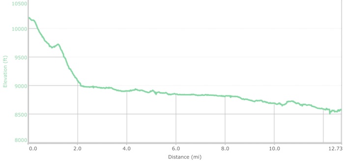
Mileage: 12.39 ● Elevation Gain: 1,044’ ● Total Mileage: 201.28 ● Total Elevation Gain: 51,906’
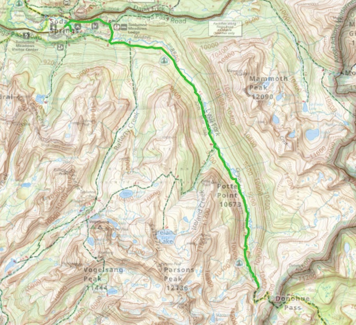
What more can we say but down, down and more down – today is all about the descent, not a huge amount at 1700′ but next to no uphill involved – this actually could hurt us more than what we’re used to. The 12 miles took us around 4 1/2 hours on sand and dirt trails, terrain that felt good on the feet, but slightly lacking in the jaw-dropping mountains eye candy department. Don’t get me wrong, the Lyell Creek hike today was very beautiful, we just weren’t up close and personal with rock and snow.
Andrea had her third night where she couldn’t sleep due to intense neck pain – she thinks it’s the heavy pack although the discomfort works its way out during the day – nothing that a dose of Advil won’t cure. As usual I saved the day with an early wake-up to fix tea and breakfast whilst she performed her stretching routine in the tent!
The rest of the afternoon and evening was a lesson learnt, definitely our worst experience of the entire hike. Our arrival into an almost empty Tuolumne Meadows backpackers campsite meant that we had the cream of the crop in tent site selection, prompting us to pick a nice spot on the perimeter of the forested area; in a hollow. We paid our fee, erected the tent, and almost instantly fell asleep – this was the first time I think either of us had napped in the afternoon. The plan was to take a short rest and for a bit of extra activity head over to nearby Lembert Dome to take in the sunset. The weather had other ideas!
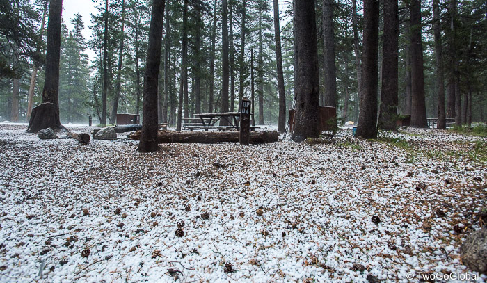
We woke an hour or so later to what sounded like heavy rain drops on the tent, turning out to be dime sized hail stones. We didn’t expect this, nor did we expect to push down on the tent floor to discover a liquid resistance. Andrea opened the flap to find her hiking shoes floating, a Nalgene bottle half submerged, and a white covering everywhere. Meanwhile the depth of water in the hollow that we had pitched the tent in was getting deeper by the minute!
The time had come to relocate to higher ground, and with conditions outside the tent it was going to be a struggle to find a new site. Trying to unpeg and remove guylines from the tent whilst being pummeled with hail was not so much fun, then trying to get Andrea out of the tent so we could lift it to a better location was challenging – she finally got out with nothing on her feet and proceeded to carry the tent 50 yards in squelching hail. Being shoeless was probably the better idea as my feet inside hiking shoes were sodden!
The tent now sat on a decent size layer of freezing hard packed hail, and we thought we were out of the woods. Little did we know that the cold would come straight up through our inflatable sleeping pads right into our bags – the night was cold, and that was with good quality Big Agnes mats that blow up to 3″ thick, and Marmot down sleeping bags. Everything in the tent was damp but at least we were dry and temporarily warm.
Even with cold feet we did manage to eat a couple of prepared meals and demolish a carton of red wine after the hail subsided. It was going to be a long night!
Lesson learned: Camping in a hollow is not recommended when a hail storm from hell is taking place!
- Second night without a bath, what’s going on
- No signs of smoke or forest fires in Yosemite
- Getting really sad that our hike is almost over
- 14 days and still no bears
September 14th 7.44am: Tuolumne Meadows to Sunrise Lakes Jct
Mileage: 11.8 ● Elevation Gain: 2,784’ ● Total Mileage: 213.08 ● Total Elevation Gain: 54,690’
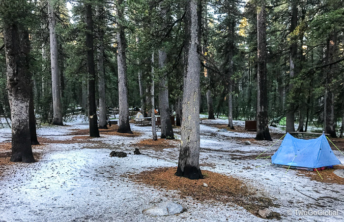
Neither of us slept much with the cold from the frozen ground biting into our bones – the entire night was miserable! Repositioning the tent onto frozen hail causing the underside of our bodies to never get warm. This was the perfect reason to get up and moving as quickly as possible. At least this mornings cold and misery did end up turning into a wonderful day.
I could almost go through it all again as Andrea actually prepared the entire breakfast, our first breakfast that is. A large bowl of oatmeal in the damp early morning was just what we needed to get motivated. The tent went away filthy and wet with all of our other stuff damp, hopefully the days weather allowing it all to be dried prior to having to sleep in it tonight! We eventually left the campsite with puddles and hail all over the place.
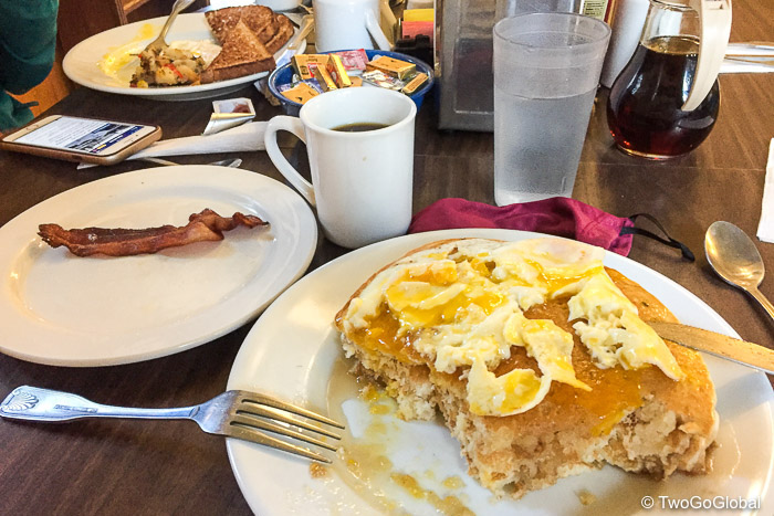
As we headed out of Tuolumne Meadows the smell from the grill was too much to resist, a second breakfast being totally acceptable after what we went through the previous day! It was delicious – bacon, eggs and cheese biscuit. Yummy said Andrea! The morning ended up being beautiful as always and definitely helped take away the chill. Hail was present on the trail for miles to come.
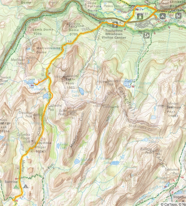
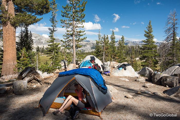
A nice and easy trail with a detour to Cathedral Lake was what was needed on this day. We managed to re-pitch the tent and lay out all our sleeping gear on slabs of rock whilst getting a birds eye view of Cathedral Peak – the weather wasn’t perfect but the sun spent enough time in front of clouds to ensure we would sleep well in a dry tent and aired out bags tonight. The trail continued with awesome views throughout the day of sharp jagged peaks.
This was one of the rare days where we knew exactly where we wanted to spend the night, a location we had heard could be hot with bears and had great views – as if we didn’t get enough of those. We were excited to get to Sunrise Lakes Junction, probably the last time we would get to see a brother and sister hiking team that we had become friends with after criss crossing paths with them since Forester Pass. The days had become considerably easier, and although the trail profiles still looked intimidating the ascents had reduced vastly, the biggest of today being a mere 650′ from Cathedral Lake up to the days 9,900′ highpoint.
As hoped the placement of the camping sites, slightly elevated on a rocky hillside was perfect, allowing us to look down onto a beautiful meadow and surrounding peaks. This was a sharp contrast to the previous afternoon! The only thing lacking at this location was a creek large enough to bathe in, leaving me to hunt down the shallowest flowing water – however I contorted my body full emersion wasn’t going to work.
Once again we’re going to rely on early morning light to wake us, that’s if we’re not woken by a rummaging black bear sometime in the middle of the night – apparently they are a pretty common occurrence here. As well as a bear we’re also looking forward to a decent sunrise from our elevated vantage point. What we’re not looking forward to as we get closer to Yosemite Valley are more hikers.
- Sadly our penultimate night of camping
- Bear boxes are almost empty, containing pre-cooked bacon amongst other goodies
- Mixed emotions now that the end can almost be touched
- Although reducing we still managed 1800’ elevation gain today
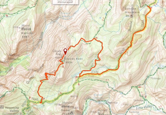
September 15th 8.43am: Sunrise Lakes Jct to Clouds Rest Jct
Mileage: 12.27 ● Elevation Gain: 4,267’ ● Total Mileage: 225.35 ● Total Elevation Gain: 58,597’
Waking up to our first frost of the hike it was a chilly morning, the tent flysheet and boxer shorts I had left outside being frozen solid. Our friends had already hit the trail and were probably well on their way to Yosemite Valley by the time we arose. Unfortunately the night offered zero bear encounters! There was absolutely no rush to be out of our little oasis, and with no plans as to what lay ahead, we took our time packing away – it was going to take a while for the tent to thaw out in the morning sun.
Due to us having no goal we mulled around trying to decide which way to leave camp; we had the option to follow the trail up to the scenic Sunrise Lakes and on towards Clouds Rest or just continue on the John Muir Trail and take our time getting to the valley. Me being me I didn’t want to miss any of the JMT so we followed it uphill for a couple of miles before dropping down 1700′ to the steep Forsythe Junction for Clouds Rest.
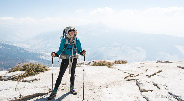
Here we had to make a decision, should we or should we not hike up to the scenic overlook of Clouds Rest? So far it had been an uneventful hiking day and this 2000′ ascent would change that – after a few minutes contemplating we decided to go for it. We’re so glad we did as the views from the top overlooking Half Dome were stunning, thanks to the perfect weather and little sign of smoke from forest fires. The hike was surprisingly comfortable if not very steep in places.
Sitting on the mountain top enjoying our last lunch was the icing on the cake for us, further adding to the experiences of the past 16 days! We now had a 2,700′ descent to the camping area. Andrea wasn’t impressed that it took a turn on her already numb toes and balls of her feet, hopeful that the sensation returns soon.
Elevated above the John Muir Trail our final nights campsite was not the best placed but sat in the sun until a little later than previous sites. Our water supply was pretty pathetic leading Andrea to fill up the bear canister to take a shower from – I was impressed and followed suit. We could now comfortably fit the remainder of our food and scented items in a single bear box – tonight would be a totally bear safe site. Maybe we should have spread the rest of our goodies around the tent in the hope that this would be the night that we did actually get to see the illusive animal!
So far my GPS files have us at 225 miles and almost 42,000’ of UP. Tomorrow we add to those numbers with our final 3,100′ descent over 6 1/2 short miles – it will be nice if the weather is on our side. Neither of us can remember what’s in Yosemite Valley but surely there will be a place for a large breakfast immediately followed by lunch.
We’re going to miss this place 🙁
- Andrea whining about having to go back to work – somebody has to honey!
- Wonder how much weight we’ve each lost?
- However much fun we’ve had camping we’re both looking forward to real pillows
Wayne’s final night comment:
Where are we going to walk to on Sunday? Maybe Mammoth Airport to collect Going Broke
Andrea’s final night comment:
The hike has been amazing and I’m so glad Wayne forced me to do it. I cant wait to sleep in a bed tomorrow with a real pillow and shower with soap and shampoo!
September 16th 7.41am: Clouds Rest Jct to Happy Isles
Mileage: 7.56 ● Elevation Gain: 656’ ● Total Mileage: 232.91 ● Total Elevation Gain: 59,253’
The 16th consecutive night spent in a tent wasn’t a good one for Andrea, not able to sleep due to the anticipation of the last days hike. Staring at the stars through the tent until around 10pm wasn’t a bad thing to have to suffer through on the last night of the trip. It’s funny that for me, towards the end I always want to get to the finish as soon as possible. Ideally we wanted to make breakfast meaning we probably had to be done by around 11am – waking again without an alarm might not have made that possible.
Even being blessed by good weather the hike to Happy Isles took longer than expected, the end uneventful due to the sheer amount of people that also like the hike up towards the waterfalls. There is a section of the JMT on the way down that bypasses the scenic Mist Trail, good in that the tourists don’t tend to use it, bad as it’s not very enjoyable in such an amazing place. For the most part the views do remain beautiful, highlighted as always by Half Dome and all the other huge rock formations that are scattered through this part of the park.
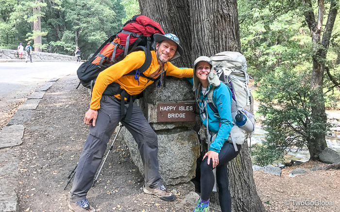
With no one there to greet us our arrival at Happy Isles was both an anticlimax and a grand finale – we were extremely happy with what we had just achieved.
Would we make our well deserved breakfast? With an efficient shuttle system a ride came along within minutes – neither of us fancied the walk to the eating joints with all the weekend tourists. Unfortunately we missed the brekkie menu but the pizza turned out to be a big hit for both of us!
Dinners
- Day 1 – Tasty Meals (heavy to carry)
- Day 2 – Pad Thai + oatmeal (not good)
- Day 3 – Mashed potatoes, beans, chicken
- Day 4 – Peanut Thai
- Day 5 – Three bean chilli (not again)
- Day 6 – Mashed potatoes, beans, broccoli, chicken
- Day 7 – Fiesta corn rice
- Day 8 – Mushroom risotto
- Day 9 – Mashed potatoes, corn, broccoli, chicken
- Day 10 – Chicken couscous w/ veggies
- Day 11 – Cheeseburgers + pie a la mode
- Day 12 – Spicy Kung Pao
- Day 13 – Lasagne (A) + Risotto (W)
- Day 14 – Mashed potatoes, corn, broccoli, chicken
- Day 15 – Fiesta corn rice
- Day 16 – Peanut Thai
Mountain Passes
- Day 3 – Forester Pass – 13,118 ft.
- Day 4 – Glen Pass – 11,924 ft.
- Day 5 – Pinchot Pass – 12,086 ft.
- Day 6 – Mather Pass – 12,100 ft.
- Day 7 – Muir Pass – 11,955 ft.
- Day 9 – Seldon Pass – 10,898 ft.
- Day 10 – Silver Pass – 10,754 ft.
- Day 13 – Island Pass – 10,205 ft.
- Day 13 – Donohue Pass – 11,073 ft.
- Day 15 – Cathedral Pass – 9703 ft.
Dates
August 31st – September 16th 2017



























Loved reading your experience on the JMT, it took me back over the miles and challenged me to think of hiking in reverse since I did N – S. Your challenging climbs were my rewarding downhills. You are a talented photographer and writer! I also loved the data you included!
Hey you two!!!
Still following you both with your adventures when I get a chance. Keep living your dreams and making your memories… Thanks for coming into our lives.
Diane
Hi Diane, great to hear from you. Hope Newfoundland is still treating you well.