Since banging out four of the Northeastern Highpoints almost a year ago the desire had returned to knock off a few more. Hip resurfacing surgery and other travel plans stood in the way for ten months bringing us to now. Once again the decision to head out west was an easy one, whereas selecting a driving route to tag at least a couple of states wasn’t. Convenience won over and the route would only take us close enough to Mount Sunflower in Kansas to justify leaving Googles directions en route to our tiny home accommodation in Lyons, Colorado.
Being situated for a few weeks in Colorado meant we were central to a handful of summits, some a strenuous hike, some an easy drive-up. The first two highpoints below were tagged on the way back from our 2016 tour of America’s Northeast.
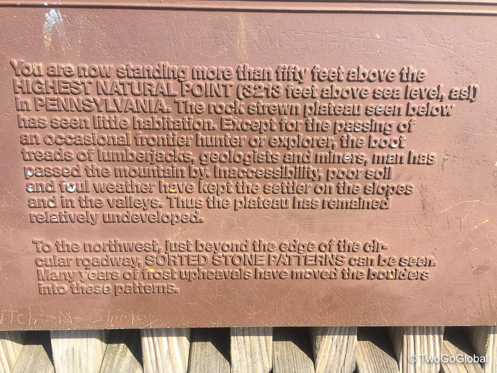
Pennsylvania – Mount Davis
Elevation: 3,213′ ● Summited: 7/22/16 ● Route: Up/ Down: Drive with 0.1 Mile Trail
With four hiking peaks under our belts we assumed that it would be usual to follow a trail for at least a couple of miles to get to the state summits – this was not always going to be the case, although there’s always the option to park up a few miles from the drivable summits and walk in for those couple of miles!
We were on our way back from visiting the northeast of the US and Canada, hence it made sense to at least try and polish off a couple of convenient ones en route to Kentucky. Bring on Mount Davis, located just north of the Maryland state line and only a ten mile detour from Interstate 68. The last section of road took us into the Mount Davis Natural Area and up the flanks of Negro Mountain, a 30 mile long ridge of the Allegheny Mountains. We parked up and followed the trail, within minutes reaching the observation tower marking the state highpoint. Maybe we should have took one of the other routes up as this was far too easy!
Maryland – Backbone Mountain
Elevation: 3,360′ ● Summited: 7/22/16 ● Route: Up/ Down: Logging Road
With plenty of daylight left after leaving Pennsylvania we drove the short 70 miles south to the Backbone Mountain trailhead, incidentally located in West Virginia. We parked on the side of US219 just outside of Silver Lake, WV and followed the well defined trail through forest for a mile, at some point crossing over into Maryland. The actual highpoint was in a small clearing with signage stating that we were now at 3,360′ above sea level. Mission accomplished!
This bought our tally for the year to a measly six state highpoints, at this rate taking almost nine years to complete them all. Hopefully 2017 delivers significantly more!
Kansas – Mount Sunflower
Elevation: 4,039′ ● Summited: 4/14/17 ● Route: Up/ Down: Drive with 0.1 Mile Walk
Not sure it was planned but our first state highpoint for 2017 was on my birthday, and although not a particularly memorable event it was good to kick off with an easy one. We had driven Interstate 70 numerous times and never realized we were so close to the highest point in Kansas, located barely a mile and a half as the crow flies from Colorado, and a short 23 dusty miles from the highway.
This was our first true drive-up, in fact we could have taken the below photo’s without stepping foot out of our SUV. Just to make us feel better we did park up along the dirt road and walk the final 100 yards to the summit marker. Looking out from there we were rewarded with 360° views of nothing, almost making us believe that anywhere out in these plains could have had the greatest elevation!
This was definitely one of the those places, like most of the state highpoints, that we would never have just stumbled upon.
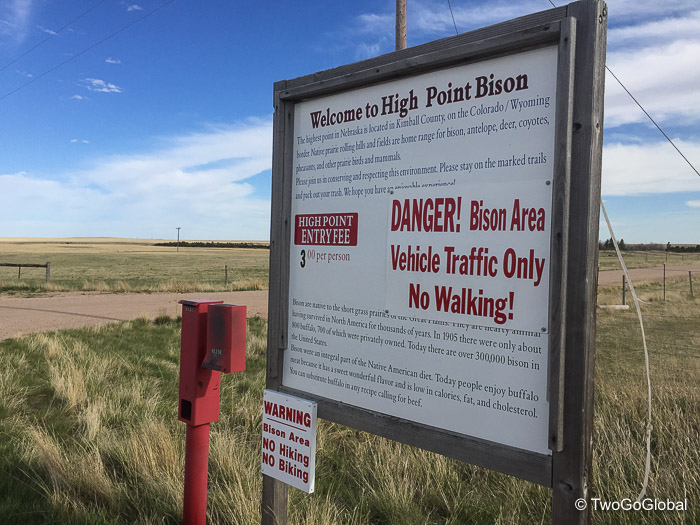
Nebraska – Panorama Point
Elevation: 5,429′ ● Summited: 4/18/17 ● Route: Up/ Down: Drive up to Marker
We had barely been in Lyons, Colorado for 4 days and I was chomping at the bit, trying to find out how close to us the next summit was located. By this point we knew we were heading to Leadville, with Mt Elbert on the cards, but I needed something in between, something easy and that we could get to and knock off after Andrea finished work for the day. I almost missed Nebraska and its location just northeast of the Colorado, Nebraska, and Wyoming tri-border. It couldn’t have been better, with Leicester City playing football on the Tuesday afternoon, then a two hour drive through Fort Collins and on to Panorama Point.
So with Leicester City only managing a draw, effectively knocking them out of the Champions League quarter finals the afternoon didn’t start off on a high note! Luckily the two hour drive to Nebraska was more successful. Panorama Point was even closer to Colorado than Kansas’s Mt Sunflower, located well under a mile as the crow flies.
We passed through the gate and signage telling us of the $3 per person entry fee – this was after all private property, and the fact that we were not to walk along the short dirt road due to this being a functioning bison farm. This time we got out of the SUV right at the highpoint and took the few steps over to the stone marker stating that we were now at 5,424′, the highest point in Nebraska.
With two down in 5 days we were flying, not even minding too much that they were both drive-ups – Mt Elbert was next and this would be a completely different adventure!
Colorado – Mount Elbert
Elevation: 14,433′ ● Summited: 4/23/17 ● Route: Up/ Down South Trailhead
With some great weekend weather allowing us the opportunity to bag a spring ascent of Colorado’s highest summit we were psyched. The Leadville airbnb we were staying at leant us snowshoes and trekking poles, items that we could never have done without – what were we even thinking planning to hike up to over 14,400′ when people were still skiing well below that elevation!
Not being overly fond of super early mornings we set the alarm for 5am and planned to be at the trailhead by 6.30am. Our trailhead selection was dictated to by the amount of snow on the mountain and as this was still very early season we decided to listen to the advice of others and head to the south, beginning at Lakeview Campground. Still only a short 15 mile drive from Leadville it was conveniently located. From this trailhead it was to be an eleven mile roundtrip hike with 4,900′ of elevation gain, making for a pretty challenging day!
Once at Lakeview Campground, and if luck was on our side, there exists a two mile 4WD road that arrives at an upper parking lot. Even though our Pathfinder is 4WD it wouldn’t have been fun getting stuck so we bailed after less than half a mile, parked up, and decided that the eleven mile roundtrip hike would be fine. Upon arriving at the upper lot we noticed a handful of other vehicles, one looking like it had the same clearance as ours – maybe we should have gone for it after all! From here on up to the treeline at 11,900′ the well used and partially snow covered trail meandered up through a forest of Aspen, solidly packed down with the freezing temperatures.
Once out of the trees the terrain became steeper with the windswept slopes shedding most of the snow. These were perfect conditions ensuring we had no reason to try out our borrowed snowshoes. The skiers and snowboarders we met hiking on the trail knew there was much more snow up there somewhere! The more elevation we gained the more we tried to stay on the bare patches and the more they effortlessly skinned up the ever steepening snowy slopes. If we couldn’t avoid the snow then we relied on the deep footprints left by other hikers, and if there were no footprints then I kicked steps into the icy snow to provide Andrea a helping hand.
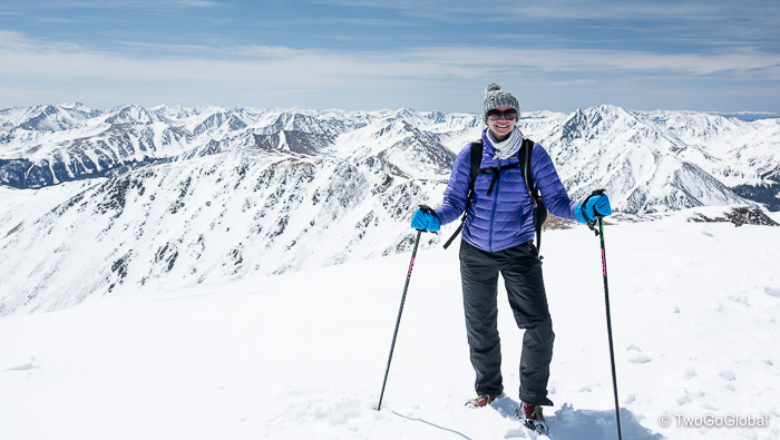
As usual a couple of false summits left us briefly frustrated, however it wasn’t too long before there was very little mountain above us, only clear blue skies and a 360° view of the Rockies. Upon our arrival on the final slope we were welcomed with typical windy and cold conditions that come with a high mountains summit.
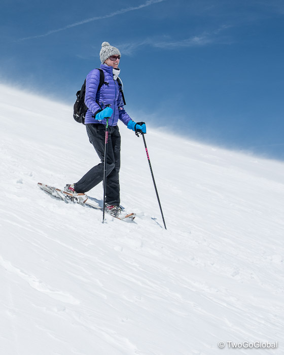
We had made good time and stood on the pinnacle of Colorado five hours after leaving the parking lot. The chilly temperature didn’t allow for too many photos so we grabbed a bunch of selfies and panorama shots and began the long descent. Once again we decided against putting on snowshoes just yet. This wasn’t to last long – the snow was far from mushy with some sections being slick. It was time to wear snowshoes for the first time. This reminded me of the time I learnt to rappel on the Lhotse Face of Mount Everest!
What a difference a new piece of equipment made, enabling us to go from slow, carefully executed foot placements to taking a direct line down the steepest sections at almost run pace. This was fun! As the trail mellowed and the snow covered sections became scarcer we switched back to hiking shoes and blazed a trail back to the waiting SUV.
The highlight of our day was a local chick out taking her dog for a walk blazing past us on the ascent, comfortably tagging the summit, then passing us once again on her way down. Apparently she does this before her morning shift begins at Leadville’s City on a Hill coffee shop!
The perfect conditions allowed for an amazing day in the mountains, prompting thoughts of another challenge – summiting the 54 Colorado peaks over 14,000′.
July 22nd 2016 – April 23rd 2017


Love the snowshoe pic!