Due to not being equipped to go beyond the Camp Muir hut on Rainier I made it a priority to stand on top of Mt Whitney in California’s Sierra Nevada range, the largest mountain in the lower 48 states. Requiring a wilderness permit for both the day hike and the overnight trips concerned me as the only ones available were walk-up permits from the Lone Pine visitor center. This had to be done the day before and was totally dependent on availability – I was fortunate to get hold of a cancellation a week prior.

Standing atop the highest mountain in the lower 48

Standing atop the highest mountain in the lower 48

It was either going to be the Whitney Trail, a relatively easy 22 miles out and back, or the Mountaineers route, covering around 10 miles – dependent on whether or not I strayed from the unmaintained trail. With my hip injury the distance of the first was not so appealing, combined with the fact that almost everyone with a permit uses that same route. I needed adventure and was totally up for getting lost or taking a fall, even after the Forest Service office warned against that route for first timers!

The Whitney Portal trailhead at 8,360 feet was a short 14 mile drive from our Lone Pine campsite, Boulder Creek RV Resort, gaining 4,500 feet of elevation in the process. A further 6,100 feet of altitude gain would get me to the summit, hopefully in less than ten hours! My plan to start prior to sunrise didn’t quite pan out and I eventually hit the trail at 7.20am, still unsure of which path to take. My mind was made up early on as I decided to take the right turn to use the North Fork trail, or Mountaineers Route – OK, now the fun begins.

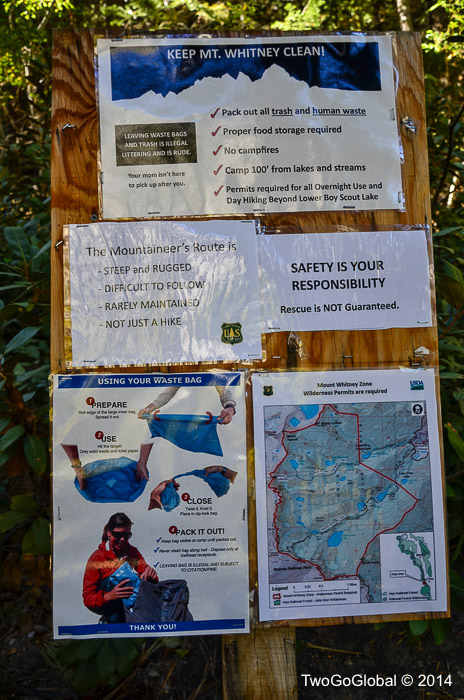
North Fork route warning board

North Fork route warning board

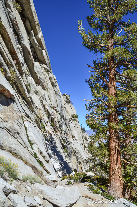
The first obstacle. Ebersbacher Ledges

The first obstacle. Ebersbacher Ledges

The first 4.2 miles to the end of the North Fork trail at Iceberg lake was not so hard to follow, other than trying to follow the cairns up the exposed Ebersbacher Ledges. Nothing too steep so far and no loss of trail – within an hour of leaving I surprisingly arrived at Lower Boy Scout lake, the first of three lakes before arriving at the scrambling section. The trail skirted the small lake and meandered its way up a rocky hillside, crossing a couple of icy rock slabs, eventually reaching Upper Boy Scout lake. I did spend some time staring at the surrounding scenery after losing the trail on numerous occasions between these two lakes, although I found that going uphill took me in the general direction.

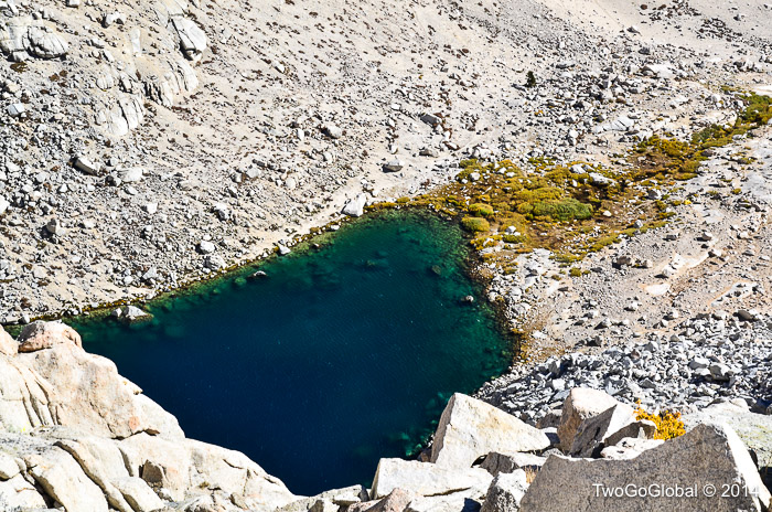
Lower Boy Scout lake

Lower Boy Scout lake

Iceberg lake at the end of the North Fork trail

Iceberg lake at the end of the North Fork trail

Upper Boy Scout lake

Upper Boy Scout lake

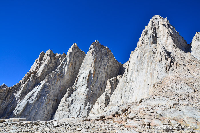
Mt Whitney on the right

Mt Whitney on the right

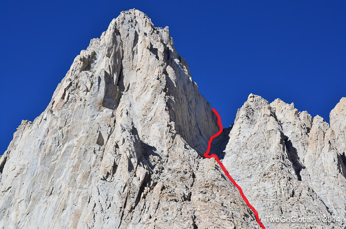
Trying to find the trail up to Iceberg lake took some searching for as there seemed to be many other less used options leading up other hillsides – if only other hikers would build bigger cairns! More time wasted but eventually the obvious route became apparent and the third lake appeared, along with a bunch of tents. From here the route took a very steep uphill path with grade 3-4 scrambling through extremely loose rock, heading up a section known as the notch – this is definitely where most of the altitude was gained. Apparently a lot of hikers use rope towards the top as a misstep could prove nasty, although not much good when you’re climbing solo.

The route up the notch, going within 300’ of the summit plateau

The route up the notch, going within 300’ of the summit plateau

The final obstacle was 300 feet of exposed rock, with nothing too vertical, but all the same not the kind of place to make a wrong move! With all the loose rock, fortunately no one was above me at any point of the steep scrambling sections or the final summit climb. A few steady hand and foot holds later and all that was left was a slight incline leading across a huge summit plateau to the 14,505 feet or 4,421 meter summit, and the top of the lower 48 states. Four hours gone and making extremely good time.

Mt Whitney summit hut

Mt Whitney summit hut

The high point of the lower 48

The high point of the lower 48

With a bunch of other people milling around at the highest point I decided not to hang around too long for risk of having anyone make my reverse down climb anymore sketchy. The easy part ended up being the steepest sections as from then on I lost the trail numerous times – nothing that some bushwhacking and rock-hopping couldn’t overcome. Less than 8 hours after leaving Whitney Portal I was back for some much needed Gatorade, thankful that almost everything had gone to plan and Andrea wouldn’t have to call in mountain rescue! A fun way to spend a day hiking but without snow Whitney just didn’t seem to contend with the likes of Mt Rainier, Hood or Shasta.

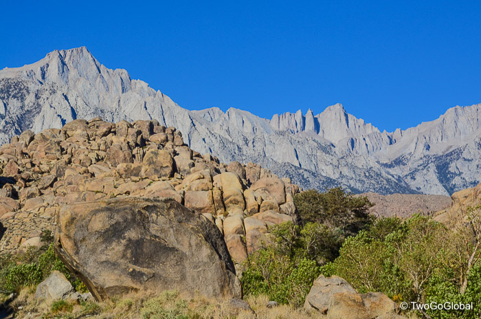
Sierra Nevada landscape

Sierra Nevada landscape

Sierra Nevada landscape

Sierra Nevada landscape

Sierra Nevada landscape

Sierra Nevada landscape

Sunrise in the Sierra Nevada mountains

Sunrise in the Sierra Nevada mountains

Sierra Nevada landscape

Sierra Nevada landscape

Subscribe To Our Blog


So you want to know what we’re getting up to whilst traveling around the world right? Yeah, thought you did. So come on, sign up here right now and we’ll be sending you a new blog whenever we get around to writing one.

You have Successfully Subscribed!