Continuing on from an out-of-the-way Iowa our route took a very direct west towards the Dakotas. We had driven this same road 3 years earlier and had been close to the places we were now revisiting for our state highpoint goal – just wish this had been on the agenda back then! After a boring Highway 90 drive neither of us had any complaints once we reached the small town of Wall in South Dakota, made famous by its 1931 drug store come shopping mall. The landscape had now changed from flatlands to Badlands, with National Forests and Monuments in ample supply. As usual the area around Mount Rushmore was awash with tourists, definitely a place to visit once then avoid like the plague!
We wouldn’t be around long, just enough time to knock off Black Elk Peak before a 200 mile drive to North Dakota. The hope was then to go for either of the regions two toughies, Gannett in Wyoming or Granite in Montana – turns out that neither would be possible due to the heavy winter snowfall that still lingered. The next nearest state would be Idaho and so the decision was made to tackle 12,662′ Borah Peak in a single day.
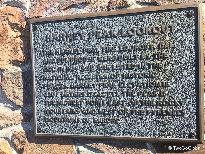
South Dakota – Black Elk Peak (formerly Harney Peak)
Altitude: 7,242′ ● Summited: 7/8/17 ● Route: Up/ Down: Trail 9 North
Driving along Interstate 90 from Hawkeye Point, Iowa and on into South Dakota meant passing through Wall, not exactly a town that could be missed due to signage along the highway for Wall Drug that began a couple hundred miles before actually reaching the place. We were lucky to find a room for the night as being the tourist town it is, beds, especially cheap beds were hard to come by! The highlight of our brief stay was dinner prepared by Andrea at one of Badlands National Park picnic areas, a place well worth the visit.
Continuing on through Keystone, a hub of activity for all things surrounding Mt Rushmore, we soon passed the famous presidential heads and found a USFS campsite to spend the night. Instead of the convenience and ease of the normal Sylvan Lake route up Black Elk Peak we had opted for the northern Willow Creek Horse Camp trail 9, mainly for its longer distance and 2,200′ of elevation gain. Anything that provided hills and longer trails for our upcoming 220 mile John Muir Trail hike was a good thing!
Changing our minds and returning to the trailhead on Saturday morning instead of almost being caught out in an afternoon thunderstorm on Friday was a good call. An early morning departure ensured we had the scenic trail to ourselves, the only signs of life being squirrels and an occasional mule deer out searching for breakfast. In the peace and quiet we followed the lower part of the route through sparse forest slowly gaining elevation until through the trees we caught sight of the Black Elk Peak fire tower located high above on the rocky peak – damn it looked a long way to go. Covering ground, even when the goal is a long way off always seems to fly by and before long we were walking up the final set of steps to the top of South Dakota.
We had timed our arrival just ahead of what looked like a couple of coach trips coming up from the easier south trail, allowing us just enough time to snap a few unobstructed pictures detailing our success. Five miles and 2,200′ of ascent done, now to do it in reverse and make the drive north…
North Dakota – White Butte
Altitude: 3,506′ ● Summited: 7/9/17 ● Route: Up/ Down: White Butte Trailhead
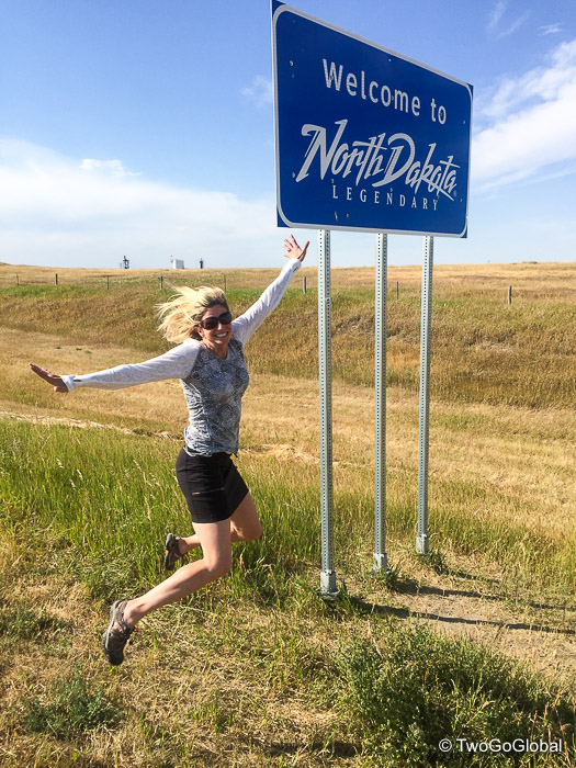
Not long before our arrival into Bowman Andrea had the satisfaction of crossing the North Dakota state line marking her 50th and final US state, taking a lengthy 43 years in the process! Along the same lines it did take me 46 years before I set foot in the Republic of Ireland, a hop, skip and jump from my hometown in England. My US tally now stood at forty eight in 14 years, only Arkansas and Mississippi to go.
Bowman, located only 30 minutes drive away from the trailhead would be our jumping off point and made for the perfect place to camp – we almost dropped over a hundred bucks to stay in a motel before stumbling upon the towns municipal campground with a modest $10 fee.
The obvious trail followed alongside farmers fencing and as long as the private property signs are not encroached upon then a few short hills and 20 or so minutes later the top of North Dakota was reached. There, as usual we scribbled our names in the registration book, spent a few minutes admiring the view and headed down. We hadn’t expected such a short hike but due to the hot conditions were pleasantly happy. On the walk back down we met a couple from Canada knocking off US highpoints before venturing closer to home to hit the significantly harder Canadian provinces. That gave me an idea!
Idaho – Borah Peak
Altitude: 12,662′ ● Summiting: 7/15/17 ● Route: Up/ Down: Chickenout Ridge
Disappointed not to be attempting the Montana or Wyoming highpoints this weekend due to significant amounts of snow we were instead forced to drive well past where we had hoped and go for a day hike on Mount Borah in Idaho’s Challis National Forest. This ended up being a fun hike taking us to places we hadn’t been, including Sun Valley and Ketchum, both recreational hotspots.
Our first port of call in Idaho was Mackay where we spent 2 nights in an RV, our very first experience in this type of accommodation. The airbnb hosts had a property with amazing mountain views and rented out their RV whilst not using it during the winter – we were happy to be back in our own private space. This also prompted us to start considering van life instead of a piece of fixed real estate. The idea of a new view whenever it took our fancy was very appealing!
Knowing we needed a very early start for our biggest peak since New Mexico the plan was to try and snag one of five sites located at the trailhead, a plan that changed after driving by Mackay Resevoir and seeing the picturesque waterfront site we could get for $3. And so it was that we dropped a full $6 for two nights not knowing what we would do after the hike.
Saturday morning came with simultaneous iPhone alarms alerting us that it was 3.30am and time to get a move on. A quick devouring of oatmeal and coffee, tea in Andrea’s case, and we were making the 20 mile drive to the trailhead. People were camped all over the place, totally ignoring the 5 site limit, most still lazing away in the land of nod! We were in lets get cracking mode and began the short eight mile return hike by 4.40am. Now for a big peak like this a four mile ascent seems pretty lame but when that short distance covers 5,262 vertical feet its an entirely different beast.
The hike started off just how it would continue for pretty much the entire way, up, up and more up. No sooner had we started than Andrea was already dreading the pounding her knees were going to take on the descent! That wasn’t the only thing, as we knew there was an intact snow bridge immediately after crossing the infamous Chickenout Ridge, named accordingly for obvious reasons – what we weren’t sure was how long and how passable it was. For now we were below the treeline and nothing else mattered.
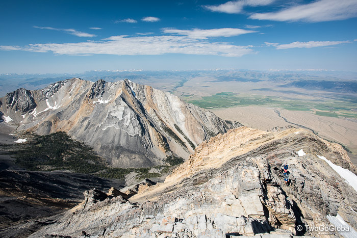
Leaving tree cover behind at around 9,500′ the trail became a little less steep. We were now headed towards the exposed Chickenout Ridge, the clear early morning skies offering great views of the rugged Lost River Range. From afar the ridge and snow bridge looked far from intimidating, whereas beyond, the summit appeared a long way up and a long way off!
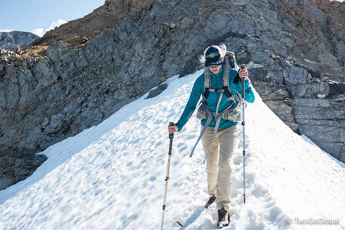
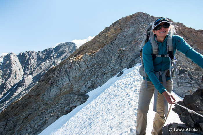
Making the most of the easier, well worn trail whilst we could we knew immediately upon arriving at the crux of the hike. The grade 3 scramble took us to the left, to the right, and directly along the spine of the ridge – an early section had me thinking that our hike could end prematurely as Andrea stood glued to a spot, unable to maneuver around the narrow ledges. With a bit of encouragement and following in my footsteps she continued on, the route being relatively comfortable, exposed for sure, but well used and easy to follow.
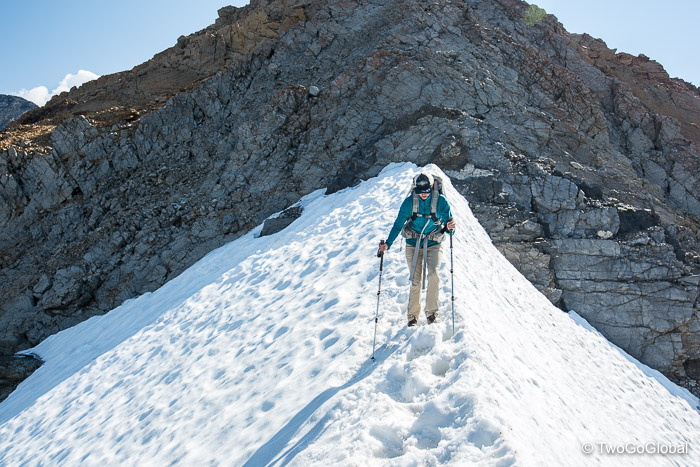
The final section of Chickenout Ridge consisted of a short down climb to a saddle, completely covered in snow, steep drop-offs to both the left and right. This must be what people referred to as the snow bridge! Trekking poles in hand I followed the centre of the saddle, kicking in the first steps of the day – a short uphill and thirty steps later once again found a decent trail. Looking back at Andrea, motionless at the top of the down climb, I once again thought that this could be the end of our day. She refused to go on! It took me kicking well defined steps back and forth across the snow bridge at least half a dozen times and walking immediately ahead of her to get her across – fortunately heading in this direction was optional, the return however being mandatory so I wasn’t currently concerned as to how she would fare going back!
The trail to the summit now became easier again as we headed towards the final 800′ of elevation on scree covered rocks. Looming high above us and initially looking a long way off, the summit quickly became closer and closer before we eventually ran out of anything higher. This was my kind of mountain, with its technical sections, frustrating scree, and exposure, all bundled into a short and intense ascent. Not sure I can say that Andrea agrees, at least not just yet.
Before a reverse of the route we took the obligatory summit photo’s and watched as the late sleepers searched for a path through the ridge and stepped into the same footprints I had made a couple of hours prior! Other than a few slips on loose scree the descent didn’t cause any issues and 8 hours after leaving the parking lot we were saying goodbye to a very fun Borah Peak.
July 8th 2017 – July 15th 2017


