Knowing that there would be a line of people by 8am at the visitor center we got up early, pigged down our last civilized breakfast and walked forty minutes to stand and wait. A half dozen vehicles were already waiting for the gates to open. Long story short but it didn’t matter if we had arrived an hour before opening or dead on 8am, our names were put into a hat and we drew numbers for order of service – Andrea picked 11 out of 13 ensuring we went from first to almost last. Lesson learned!
An hour later with permits issued, trail do’s and dont’s out of the way, and poop bag for the Whitney Zone in hand we hitched a ride back to our hotel. Now we had to try and thumb a lift the 13 miles up to Whitney Portal from Lone Pine – shuttle services in the Sierras are outrageously priced! Thirty minutes went by and conveniently one such shuttle driver was heading up to collect a couple paying the small fortune to take them to Yosemite to begin their hike, providing us with a cheap twenty Dollar ride to our departure point.
Day 1
August 31st 10.05am: Whitney Portal to Trail Camp
Mileage: 6.12 ● Elevation Gain: 3,628’ ● Total Mileage: 6.12 ● Total Elevation Gain: 3,628’
Despite our early arrival time at the camping area, followed by much back and forth about whether to continue on up to Trail Crest, we decided to spend the night here. The decision was ultimately due to the lack of water between here and Guitar Lake which we wouldn’t reach until the following day sometime. It was a little after 2pm and only covering 6 miles of an expected 13 was slightly disappointing. Fortunately we did have 16 days ahead of us to make up the 7 mile shortfall. Sitting at a lofty 12,000′ Trail Camp has ample places to pitch a tent, some definitely more exposed to inclement weather with a location away from the protection of rocky overhangs. Weather was not something we thought about when selecting our site, albeit we did have a small wall to protect from the wind!
Pity our small wall did nothing to keep out undeterred marmots and chipmunks, both which had zero fear of humans. We had been told to leave our packs unzipped with no food inside, this way they could climb inside, have a nose around, and leave without gnawing their way in or out. We’re already suspicious that Andrea’s new Osprey backpack has been the victim of a pesky rodent – one of the shoulder straps has been ripped or chewed half way through, temporarily repaired with a generous amount of duct tape.
Without having to dip into our bear boxes we prepared the additional food that had been hanging from the back of Andrea’s pack (9 days of food takes up a lot of space!). If dinners during the rest of the hike are so tasty then life will be good. Snack times may not be so good however as another ziploc bag of Jerky is showing signs of mould – not the best thing to be eating until we leave the Mt Whitney Zone wilderness as if we use the supplied poop bag we have to carry it until at least Muir Trail Ranch some 8 days away. Rules say that ‘everything’ has to be carried out from the Whitney Zone, including poop, then once we’re in Sequoia and Kings Canyon National Parks there are no places to officially dispose of trash, except we can then bury poop!
Bed came early as we planned on a 2am alarm to try and reach the summit for a spectacular sunrise. What we hadn’t planned on was hitting the sack by 6.45pm, seeing distant lightning soon after, then spending the next few hours going through a thunderstorm from hell. It was amazing how quickly conditions had deteriorated from the clear blue skies we had enjoyed all afternoon and into the early evening.
With knees bent and hands and feet placed firmly on our sleeping mats we hoped it would blow over. At the time we weren’t sure how other campers were responding, some camping in worse places than us. After an hour or so of relentless lightning things started to calm down – now the appetizer was over the main course could be delivered. The thunder became far louder, the lightning far brighter, then came hail. We couldn’t help but chuckle about a local guide earlier telling us that storms rarely hit during the middle of the night, and here we are! It wasn’t looking promising for our early departure.
No sooner had we fallen asleep than the 2.15am alarm was telling us it was time to get up, current conditions saying otherwise. We both fell straight back into a stupor until 4am, eventually woken by the sight of headlights creeping up the mountain towards Trail Crest. It was time to go…
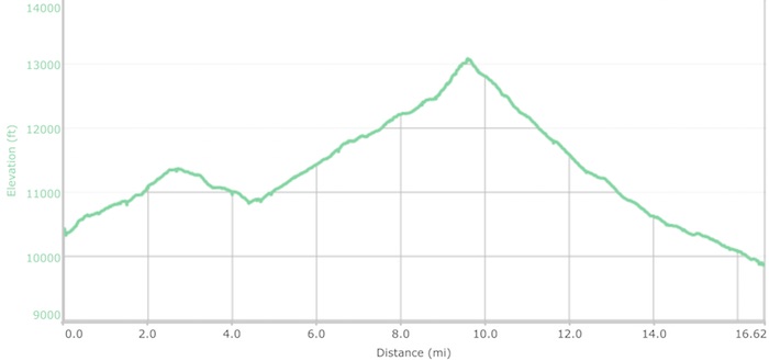
September 1st 4.42am: Trail Camp to Wallace Creek
Mileage: 15.87 ● Elevation Gain: 4,267’ ● Total Mileage: 21.99 ● Total Elevation Gain: 8,250’
Andrea’s sypnosis…
Started feeling dizzy about half way past Trail Crest to summit. Thought I was going to pass out. We didn’t bring food or water. Stupid! Kept thinking about birth control pills causing blood clots at high altitude. Decided to lie down in snow and elevate feet above my head. Wayne was mad! Laying down helped a bit. Tried walking but same thing. My stomach was also upset. Went for poop amongst rocks and was able to summit. No blood clot after all!
I’m sure passing hikers thought there was a serious problem, seeing Andrea lying in the snow amongst rocks, legs up in the air, stuffing snow into her mouth.
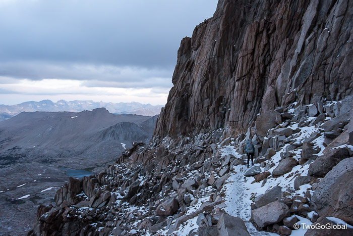
Early cloud having dissipated, we arrived at the 14,505′ California highpoint to perfect blue skies and only 2 other people. We had passed a handful of others already making their descent, most having been on the trail for many hours after starting from Whitney Portal around midnight. A few photos and the obligatory Facebook update and we hastily began our own descent, uneventful now that Andrea was back to firing on all cylinders. We arrived back to Trail Crest a little before 10am, five long hours after departing camp. In that time we had covered a mere 6.2 miles of the days 13 mile minimum. This was an almost perfect start to the adventure that lay ahead, an adventure that with the highest point done and dusted was all down hill from here.
From our vantage point at Trail Crest it felt like we could see forever, with the Sierras spread out before us and our next port of call, Guitar Lake, glistening in the sunshine down below. We were impressed with the non too shabby welcome into Sequoia National Park where we would be spending the next week.
Our arrival at the lake couldn’t come fast enough, both excited about brunch after not having eaten since dinner the previous night. Today was going to be an experiment with the first of Andrea’s pre-made breakfast concoctions, a mixture of Bob’s Red Mill instant rolled oats, freeze dried berries, banana, and apple, dried milk, chia seeds, and in Andrea’s case, powdered peanut butter – all we needed to do was boil water, put a couple of cups into the oatmeal ziploc bags and drop them into the super convenient padded foil ovens to cook for a few minutes. The result was perfection! Washed down with dual servings of Aeropress filtered coffee (one of my luxury items), and tea for Andrea, we were set.
The setting was so tranquil we could easily have stayed here the night, and with all our camping gear outside drying in the sun it was very tempting. Later in the day as other hikers rolled in this very popular camping area set right on the lakes shore would be a mass of colorful tents. Unfortunately we had to pack everything up as there was no way we could cut our second day short, especially not when the time had barely moved from morning into afternoon!
From Guitar Lake we had a fairly comfortable hike taking us past the Crabtree Meadow ranger station and on to Wallis Creek, increasing our days mileage to almost sixteen. By the time we arrived this was another busy camping area, tents scattered amongst the trees taking up most of the available sandy spots. We were far more concerned with changing into fresh clothing and dunking our tired feet in the cold creek!
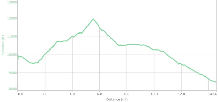
September 2nd 7.07am: Wallace Creek to Upper Vidette
Mileage: 16.08 ● Elevation Gain: 3,816’ ● Total Mileage: 38.07 ● Total Elevation Gain: 12,066’
The days hike began with a meandering 900′ climb, the first part out of camp providing enough incline to ensure we were fully awake. Crossings of Wallis and Wright Creeks provided a welcome distraction from the ascent, the latter requiring us to remove shoes and socks – this was also the place that we met a Russian in a hurry. The guy didn’t bother to remove anything and skipped straight through the water. He did have time to explain to us that in 6 days time he was meeting friends in Yosemite Valley and needed to cover around 35 miles a day to get there, hiking through the night and with minimal gear to make it happen! Suffering through 16 miles was more than enough for us lightweights.
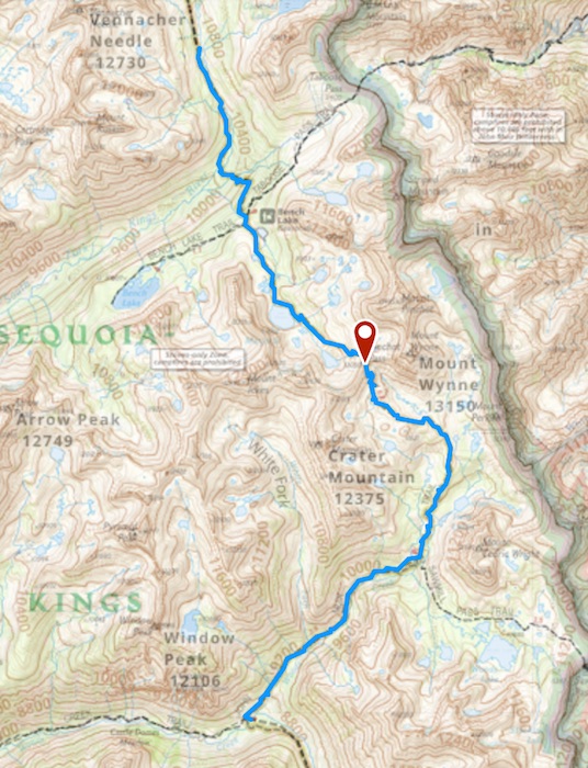
On and on we went in glorious sunshine, covering over 9 miles before the days big hurdle, 13,153′ Forester Pass. The terrain was stunning, taking us through so many different environments before our arrival at a wall of jagged peaks, the gateway over the highest pass on the JMT not making itself obvious.
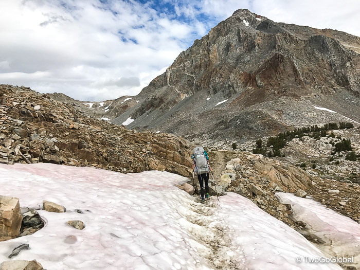
To make the necessary elevation gain we followed countless obligatory switchbacks, each one concealing the next, each one providing the ascent we needed to get to the top of this steep engineering marvel. Built back in 1930 with the support of a government that was all about the construction of the John Muir Trail, a project that would never happen in todays world – there’s definitely something to be said for those that came before us and pioneered these long distance trails. From now on forward the passes apparently get gradually easier, at least in altitude, providing a really good reason to be doing the hike from south to north.
Reaching the top of the pass took us into Kings Canyon National Park, offering the same stunning scenery we were now taking for granted. As we keep saying to ourselves; there’s nothing that’s not eye candy on this hike! The top of Forester Pass was where we met Maria and Alfred, a brother and sister team that were on their second JMT hike – we continued crossing paths for the next 12 days, obviously enjoying each others company. Heading down the rocky switchbacked descent, still with random patches of snow that the trail detoured around, we finally arrived at a crystal clear creek, an ideal place for a well deserved late lunch and afternoon snooze.
After what seemed like an eternity our arrival at Upper Vidette couldn’t have been more welcome, stumbling upon a perfect campsite right on Bubbs Creek. Having managed another 16 miler we were now only a single mile behind schedule, regaining the lost miles from day one far quicker than expected. Both of us were unfortunately paying a price for these long hiking days with heavy packs, me with sore hips and shoulders and Andrea a dodgy ankle – for the following day the fully flexible plan was to reduce the mileage back to the scheduled thirteen. We both agreed that mile thirteen seemed to be about the distance where we wished the days hike was coming to an end.
We had Settled in to camp nicely even though tonight we had a new threat, and instead of being bombarded by mosquitoes we had to contend with the high possibility of bears, something recently noted on every direction sign since dropping down off of Forester Pass. Even after 3 days of food consumption our bear boxes still seemed full, definitely too full to squeeze in all the aroma rich products that don’t need to be in the vicinity of the tent – once again we utilized our odor free bag. In it went tooth brushes, paste, wet wipes, mints, lip balm, coffee, trash, and anything else we thought may attract an unwanted visitor. Even though I felt good about using one these bags are probably useless as they are not on the list of permitted bear canisters, made even worse that I’d normally just sit it between a couple of rocks within spitting distance of where we were sleeping!
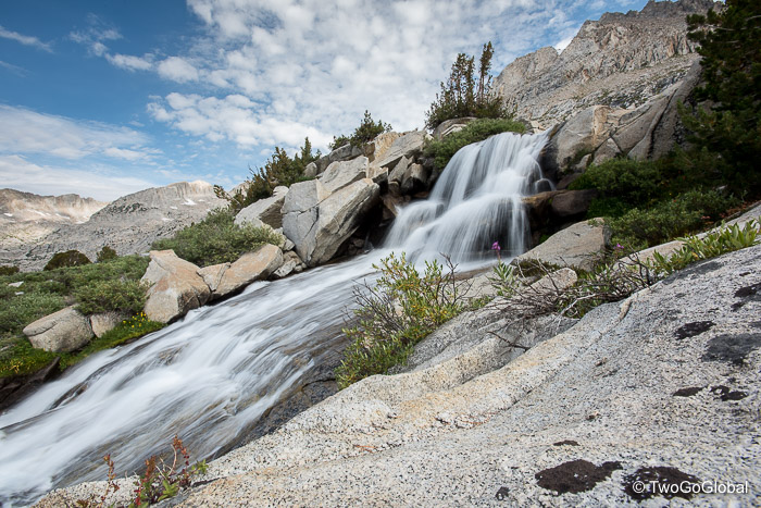
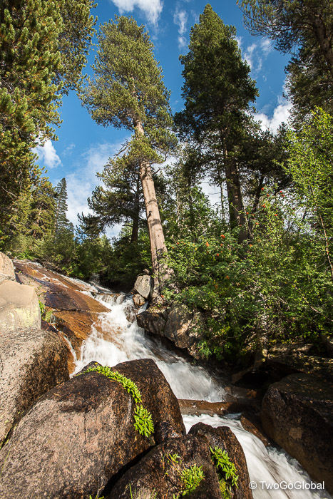
The reward for all the miles we had put in today was a bath, most definitely not the warmest, but a bath all the same. We were camping next to a perfect waterfall fed pool on the edge of the creek, complete with a smooth rock finish and desirable sun facing direction. With no stickiness, the sound of flowing water and our own private waterfalls we were going to sleep like babies tonight!
September 3rd 7.03am: Upper Vidette to Woods Creek
Mileage: 14.04 ● Elevation Gain: 3,576’ ● Total Mileage: 52.11 ● Total Elevation Gain: 15,642’
Not for the first time a dull and annoying ache in my left hip prompted a crap nights sleep, somewhat improving the moment I was up and about. Although not an ideal start to the day the discomfort did mean that our days tended to begin before daybreak. Not the only thing that made the start to this day slightly below par, the other being breakfast – prior to beginning the JMT we had planned breakfasts to be 3 days of oatmeal blend followed by a day of scrambled egg and bacon wraps. Even though we had picked the Mountain House brand, apparently the best of the bunch, it had a lot to be desired. Probably made worse by Andrea mixing with double the amount of water!
Our hike today included knocking off 11,926′ Glen Pass – sitting over a thousand foot lower than Forester of course would make it considerably easier, wouldn’t it? This was the second consecutive day of a weeks worth of high mountain passes, a day where we passed alpine lakes complete with icebergs, and followed a trail that felt steep but never seemed to gain altitude. Camping 4.5 miles away meant we should get a nice warmup before hitting the top, never really materialising but still better than beginning at the base of the uphill climb. As usual looking down from the windy summit provided views that made the effort well worth it.
Considering today was supposed to be an easier day it had taken us far longer than anticipated to get up and back down Glen Pass, the loose rocks end uneven terrain making the descent brutal on the soles of my feet. Luckily for Andrea her ankles were feeling better!
Not the best timing as beyond Glen Pass were the highly recommended Rae Lakes, consisting of upper, middle and lower lakes, all offering many beautiful spots to spend the night. Arriving at lunchtime was never going to work! It was; however, the perfect place to stop for lunch and take advantage of numerous flat rocks complete with back rests. Beyond Rae Lakes the trail meandered along a creek passing by Arrowhead and Dollar lakes, again both worthy places to stop. Once again we skipped on past, finally dropping our backpacks 4 miles further along the trail at a relatively un-scenic Woods Creek. The day had dragged on for too long, and although we had made up another mile with a 14 mile day, we were beat and wished we had stopped on one of the picturesque lakes.
Woods Creek did offer a great place to get a good dunking and clean off the days sweat and dirt, providing we could handle the bitterly cold water. Another good reason to camp on a lake instead of a creek – the water is considerably warmer! As usual the afternoon ritual began with a cold bath, briskly moving on to hot drinks, in my case 2 cups of Europress filtered coffee, and Andrea would always take an organic tea. These were our luxuries!
- We had now made it to the end of day 4, hiked a total of 52 miles which covers almost a quarter of the trail, and were back on a 13 mile per day schedule.
- Both backpacks seemed no lighter, even with 4 days, or 50% of our food gone!
- Sitting on top of my pack for the day, the first use of a small camping solar panel worked a treat
- Our new Sawyer water filter still hasn’t been used, instead preferring the easier Steripen option with the amazingly clear water
- Another day of almost perfect weather, briefly interrupted by a sprinkling of rain after crossing Glen Pass
- A friendly deer almost allowed us to reach out and touch it
- Bringing along Emergen-C and Tang was an eagerly anticipated alternative to snow run-off flavored water
September 4th 6.14am: Woods Creek to Upper Kings River Crossing
Mileage: 13.49 ● Elevation Gain: 4,763’ ● Total Mileage: 65.6 ● Total Elevation Gain: 20,405’
Due to the sun, afternoon thunderstorm risk and todays 12,086′ highpoint, Pinchot Pass, sitting 7.6 miles along the trail we opted for an early start. Andrea once again allowed me the luxury of getting up first and preparing breakfast – also our ultralight REI tent is so small that for the two of us to get dressed and packed at the same time causes flying elbows and an unnecessary commotion!
Unlike yesterday’s climb the 3,600′ ascent of Pinchot Pass was a beautiful hike, with waterfalls and multi-colored peaks providing plenty of distracting eye candy. Sunny blue skies overpowered the windy conditions and set up the scenery perfectly.
North of Pinchot Pass another of the numerous lakes we had been told about that came with a high wow factor was Lake Marjorie, supposedly shimmering with the bluest waters on the trail. Slightly overcast, today didn’t appear to be a day for experiencing the bright blue color, or were we expecting too much? When we hear or read about what others class as amazing we’re often underwhelmed – too much of a good thing I guess!
Nonetheless it was a perfect place to stop for lunch, eagerly anticipated since breakfast. Usually consisting of peppered salami, sundried tomatoes, jalapeño or some flavor of Babybel cheese, all bundled onto a large wrap and smothered in hot sauce, washed down with orange Tang. Not a feast by any stretch but this had become the excitement for our day! Snacks in the form of Bobo bars, Clifbars, or Probar Meals either side of lunch tied us through until dinner.
We could have called an end to our day a couple miles earlier than the 13 or so we managed but thought it would be a good idea to get some of the following days ascent completed beforehand. Continuing on enabled us to find the perfect place north of the lower Kings Crossing, sitting elevated right above Kings Creek. There was just enough room on a flat rock platform for a single tent providing us complete solitude and amazing views – so far we’ve been camping in popular areas with a handful of neighbors. Today our only companions to enjoy the perfect afternoon with were plagues of relentless mosquitoes!
As well as being our best hiking day so far, that is if we don’t count Andrea taking a plunge into a creek crossing, we also achieved the most elevation gain with over 4,000′ of upwards travel. On that same creek crossing me being me thought I could get across without removing shoes, hopping between rocks and tree branches – halfway across, complete with an audience, I realised I could no longer continue forward or backwards. Not sure why but there was no applause for the balancing act I pulled off to remove shoes and socks, remaining dry throughout!
- Andrea complaining of new blisters beginning to form, prompting for more Vaseline tomorrow
- She now has sticky sap on her sports bra after hanging it in a tree!
- Three days from 3 of getting totally submerged in a cold creek for bath time
- Aches and pains becoming fewer by the day
- Seemed to encounter lots of bearded characters on the trail, mostly PCT through hikers
- Our tent exterior was covered in mosquitoes tonight, all in a frenzy to suck on fresh blood
- We should be at Muir Trail Ranch in 2 1/2 days and will hopefully have empty bear boxes
September 5th 4.46am: Upper Kings River Crossing to Bishop Pass Jct
Mileage: 18.18 ● Elevation Gain: 3,808’ ● Total Mileage: 83.78 ● Total Elevation Gain: 24,213’
With the tent flapping and a full moon shining in throughout most of the night we missed out on the good sleep we had hoped for. Planning on making the top of 12,100′ Mather Pass by sunrise we set alarms for 4am, waking us a little earlier than usual but more than doable. This was to be another get-up-and-go day with breakfast planned for somewhere over the far side of the pass. Unfortunately us not realising the distance we needed to cover and having to negotiate a sketchy creek crossing in the dark we missed what could have been a mediocre sunrise – the route up to the pass was never going to reveal anything too spectacular. From the top we did get to see the surrounding Palisade Peak summits illuminated in a beautiful red alpenglow.
It was 7am and we had spent the 2 hour hike competing for the loudest, smelliest farts! Something to do with the 3 bean chili we had eaten for dinner – Andrea vowed to never get that mixture again. With us already having bagged most of the days elevation gain from here on out it was all about descent, the route taking us down over 4,000′ to a lowpoint of 7,854′ before a slight uphill to our campsite at Bishops Pass Junction.
Waterfalls up above us and the long sparking Palisades Lakes down below, this was the place for a mid-morning breakfast. The early morning ensured we were making good time so this was a great place to refuel and take in the views for a while. Shortly after reaching the end of the lakes we began a more significant descent down what is known as the Golden Staircase, the final section of trail to be built back in 1938 – truly an engineering marvel cut right into the side of the mountain with exposed switchbacks and Palisade Creek tumbling alongside. This was impressive stuff that seemed to go on forever. Our beat up feet didn’t quite agree!
Following the creek we continued heading down, a little mundane compared with where we had come from, but still eating into the big mileage we had set ourselves. A little rain and a mixture of stormy and sunny weather kept the hike varied. By days end we had covered over 18 miles with a comfortable 4,000′ of descent and a pretty big pass thrown in. This was our greatest distance so far, one that Andrea could attest to with her notebook quotes… “My feet were done at mile 15 but needed to get to camp at 18 miles” and “Starting to worry about blisters”.
Home for the night at Bishop Pass Junction provided a tailor made platform, chosen by Andrea and perfectly sized for our palatial tent, chilled bathing pools in Middle Fork Kings River, and bear protection from the close by Le Conte ranger station. Hopefully at some point we get to actually need protection from a bear! The only downside was the replacement of mosquitoes by ants.
Our bear boxes were now well below half and with only a couple more days to a complete refill it was time to indulge, in my case overindulge! With pre-cooked bacon, prosciutto, cheese and scrambled eggs these were happy times. On top of the first class menu it was also nice to double refuel on Emergen-C orange washed down by filter coffee; EuroPress style, and in Andrea’s case English breakfast organic tea.
I was hopeful that after a freezing creek bath maybe the hip wouldn’t make me suffer tonight.
- Legs are feeling stronger and looking more skinny each day!
- Nice to be able to switch between the same 2 pairs of boxers every other day
- Technology of solar panel and power bank is keeping everything charged perfectly
- Spent evening with friendly deers in camp
- Pikas, marmots, and chipmunks are by far the most common wildlife
- Six days without a single bear sighting – maybe tonight
- NPS Ranger asked for our backcountry permit today
- Averaging 14 miles per day so far
- No night time condensation so tent, bag, etc. are completely dry each morning
September 6th 6.33am: Bishop Pass Jct to Evolution Lake Outlet
Mileage: 13.96 ● Elevation Gain: 4,536’ ● Total Mileage: 97.74 ● Total Elevation Gain: 28,749’
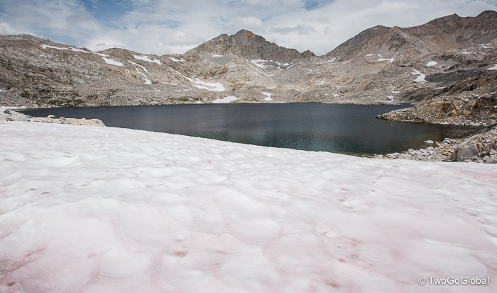
A 6.30am departure signaled the beginning of our best hiking day so far, packed with spectacular scenery, beautiful waterfalls, wildflowers, snowfields and meadows. The final couple of miles up towards Muir Pass took us past jagged peaks and isolated alpine lakes, one such lake named after Helen Muir, the youngest daughter of the trails founder. We were now encountering more snow coverage than we’d experienced during the entire previous week. The higher we got the more rugged the surrounding mountains became, and coupled with a sky showing signs of an impending storm countless photo-ops stood in our way.
We had seen few other hikers today and with all the late lying snow the trail wasn’t always easy to pickup. Even though Muir Pass was easily visible it still required a slog and a little route finding to gain the 11,955′ summit. Five fun hours after departing camp we reluctantly traversed the final snowfield leading to the highpoint of the day. Unlike other passes we had navigated this one came complete with the 1930 constructed John Muir Memorial Shelter, a stone structure built by the Sierra Club in honor of John Muir. Luckily for us the weather remained calm as we had no desire to join the clan of 20 somethings packing out the inside.
The excitement of the ascent now over and wth Muir shelter slowly fading away behind us all we wanted to do was eat. About a mile down a huge flat top rock on the side of the trail became our dinner table, and with our usual delicious wraps of cheese, salami and sun-dried tomatoes we refueled in preparation for the second half of the day. We’re always super enthusiastic about our lunches and this one was no different! The weather west of the pass was closing in and the chance of rain looked more probable further down towards Wanda Lake – would this be our first day using rain gear?
Not too long after filling our faces, and perfectly synchronized, we both had an overwhelming desire to offload some of what we had consumed earlier – luckily no one was around but it would definitely have looked comical seeing us both rush off in different directions to find privacy rocks. By this point the rain had started. It was a pity the weather had turned as we were now entering Evolution Basin, an area considered one of the most beautiful of the hike, if thats even possible.
Passing by Wanda Lake, Sapphire Lake and numerous others lining the route we eventually arrived at Evolution Lake. Thankfully we didn’t stop to camp before making it this far as this area was stunning. Although the weather switched from rain to sun to rain to sun to rain, and finally sunset, the view back to where we had just come was sublime! To our left it was stormy, to our right the sun was shining and right in front of our eyes a rainbow.
We were lucky in that we managed to erect camp seconds before the next bout of rain came through, and even luckier that we cooked a very tasty Fiesta Corn dinner without getting soaked (we did have to dive into the tent to eat it). Fortunately our dinners were far better than our scrambled egg wrap breakfasts we had to endure every third day. We can only hope that when we reach our resupply canister tomorrow it doesn’t contain anymore dried eggs!
Getting caught in a shower whilst wallowing in the lake wasn’t so much fun, made even worse with no sun and the cold water. At least lake water is warmer than flowing creek water. Andrea is concerned her hands are getting too much sun and plans on wearing gloves for longer each day, personally I just think its the ingrained dirt.
Hopefully another great sleep will come our way tonight as it did last night…
- Rodent chewed on food ovens overnight
- Almost empty bear boxes
- I’m getting concerned that my coffee supply lasts – maybe I should dive into Andrea’s tea!
- Days are flying by and with all the natural beauty I never think about work (Andrea’s quote)
- We are both loving hiking from south to north, especially having the sun behind us most of the day
- The John Muir Trail us up there with the best hikes on the planet
- Huge day of descent down to Muir Trail Ranch tomorrow
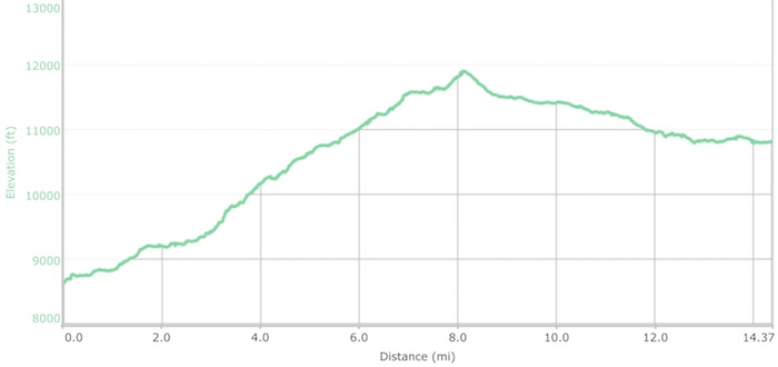
September 7th 5.57am: Evolution Lake Outlet to Muir Trail Ranch
Mileage: 15.56 ● Elevation Gain: 1,754’ ● Total Mileage: 113.3 ● Total Elevation Gain: 30,503’
Neither of us were sure whether this was a day to be excited about or dread, after all it is the day when we get to see the inside of our resupply container. Exciting because with breakfast out of the way and morning snacks in our pockets our bear boxes were temporarily bordering on empty, ultimately meaning that our backpacks were the lightest they had been so far and we get to enjoy new food. Dreading due to our resupply container weighing in at a hefty 27 pounds when it was shipped 6 weeks earlier, the contents more than enough to completely fill what was now empty!
We arose early, probably around 4.45am, to a beautiful sky full of stars and a full moon. I always felt great being up and ready to leave at such an early hour, unlike Andrea whose attitude was “Wayne makes me get up otherwise I’d sleep in until 7am!”.
It was going to be one of those days, a long and relentless, albeit fast, 15 miles of downhill to Muir Trail Ranch. The sky was too blue, the temperature too warm, and we were sadly missing a grueling climb to the top of a mountain pass. For Andrea her least enjoyable day so far! Beginning with a brisk chill in the air the first section leading to Goddard Canyon junction continued along Evolution Valley and its namesake creek, passing by waterfalls cascading over huge flat rocks and bear free meadows covered in frost. Where were the thousands of bears that supposedly exist in the Sierras?
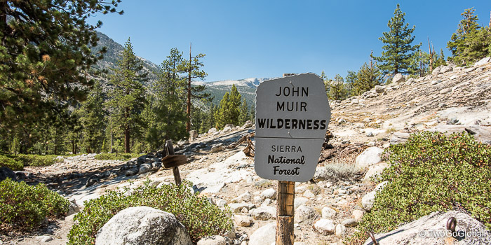
The day improved as we picked up the San Joaquin River and its tumbling cascades. After 7 days we exited Sequoia and Kings Canyon National Parks and entered what was destined to be an equally impressive John Muir Wilderness. Four miles further, slightly detouring away from the JMT, and we arrived at the entry to the horse ranch and our resupply point – the long descent was done!
It had taken us 7 hours to cover the 15.5 miles, the continuous descent making it mundane for sure but the relatively lightweight packs making it tolerable. Now do we take the left fork and the short steep downhill to set up camp first or do we take the right fork and go get our bear box refills? There was no need to add more to our packs just yet so we chose camp. We found the campsites here better than expected, both of us thinking that with all the people passing through it was going to be a zoo – finding a site on a small flat plateau worked out perfectly. We were both glad not to be staying at the actual Muir Trail Ranch as it would have felt like we cheated.
With Andrea carrying her bear box in her backpack (already anticipating the weight) and me with mine under my arm we took the short walk up and back down to the ranch. The assistant had no problem pulling out our bright orange Home Depot 5 gallon bucket – with years of practice their storage facility is run well as just about every item is a bright orange Home Depot 5 gallon bucket. Now the fun begins! Tipping the contents out all over a tarp we waded through the mass of Ziploc bags, separating the packages into breakfast, lunch, dinner and snack piles. We had put in too many dinners so contributed to the 10 or more shared buckets that hikers can help themselves to. Other than that we were happy, with everything we sent still looking more than edible – the jar of Justin’s Chocolate Hazelnut Butter being our eagerly anticipated treat!
Deciding to spend the night at the public campground gave us easy access to the also public hot springs, another of the days highlights. Fortunately someone had fixed a rope across the fast flowing San Joaquin River making the crossing somewhat easier. A couple hundred yards across the river we stumbled upon a couple of water filled holes, the first looking clear and inviting, the second mirky but hot – we headed back to the smaller clear pool, and with no one else around spent an extremely hot and relaxing half hour giving our legs some greatly deserved therapy and relaxation. Being very natural, the moment we moved the silty bottom stirred up covering us.
The San Joaquin River was the perfect place to clean ourselves of all the silt and provide our clothes with a good wash, almost on par with a washing machine. The beautiful sunny weather ensured everything dried. Beginning the second half of our hike in the morning with clean clothes and chocolate hazelnut butter would hopefully offset the additional weight!
- Sad to be just past the halfway point
- Love seeing people of all ages doing the JMT
August 31st – September 16th 2017


